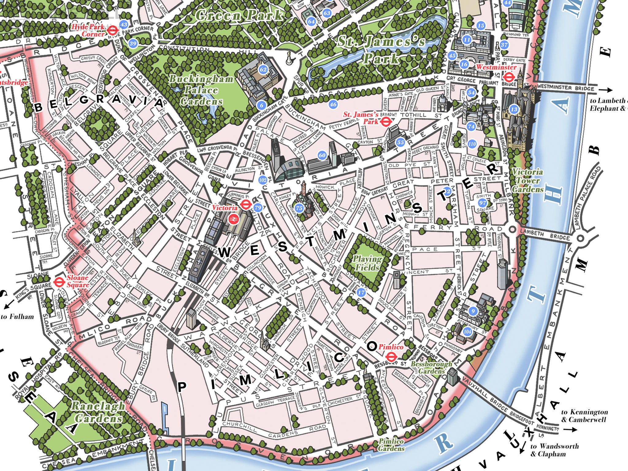
This is an original illustrated map of the City of Westminster, a borough of London, UK, inspired by decorative antique map prints and entirely hand-drawn and digitally coloured.
The decoration draws on the area's rich culture and history. The border echoes the ornate detailing around Big Ben’s clock face, with the compass on the left inspired by its distinctive appearance. At the bottom centre is the official coat of arms of the borough.
Six heraldic shields on the left represent key figures and families: the Earls of Bedford (Covent Garden), the Grosvenors (Mayfair, Belgravia, Pimlico), the Portmans (Marylebone), St. Peter (patron of Westminster Abbey), Edward the Confessor (the abbey's founder), and the portcullis symbol of Parliament.
The illustrations include the statue of Anteros ("Eros") at Piccadilly Circus (bottom left) and Marble Arch at the northeast corner of Hyde Park (top right).
- High quality digital giclee print on archival paper
- Available in two size variations: choose from the menu above
- Signed in pencil by the artist, with a stamp of authenticity on the rear
- Open edition - printed to order
- Frame NOT included
Carefully packaged and delivered in a firm cardboard tube.