Mike Hall is a freelance illustrator and designer based in Valencia, Spain.
All of Mike's print designs are completely original, unique creations designed entirely by hand, requiring many hours' worth of research, dedication and hard work. All are inspired by his facination for historic cartography as well as design, culture and architecture; the perfect gifts for map lovers and travellers everywhere.


NEW BOOK: The Boroughs of London
Co-written with Londonist editor Matt Brown, Mike’s debut book The Boroughs of London explores all 32 of the city’s boroughs, tracing their origins, differences, and possible futures. Richly illustrated with colourful maps and detailed drawings, it's a must-have for London history buffs and map enthusiasts.
Available now from Batsford Books and other online retailers.


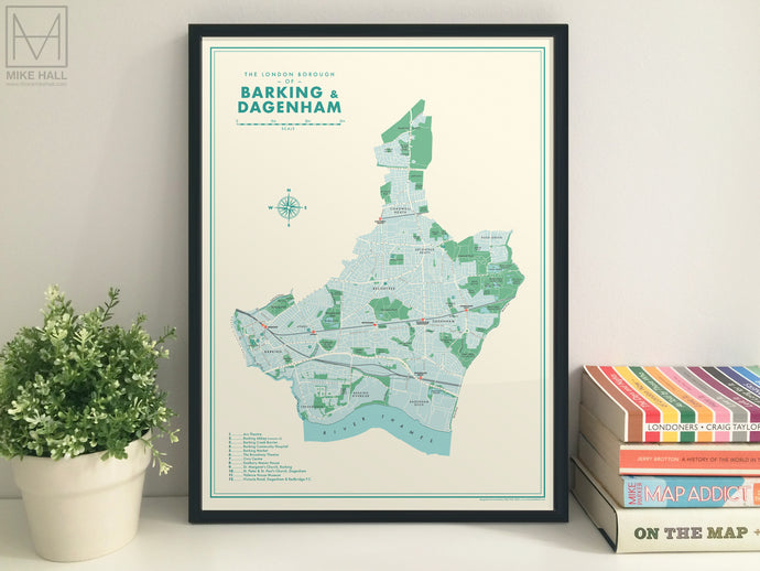
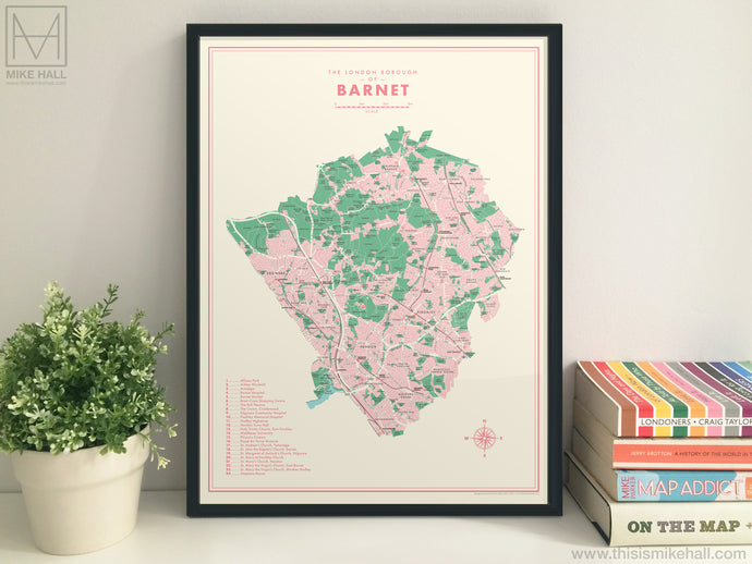
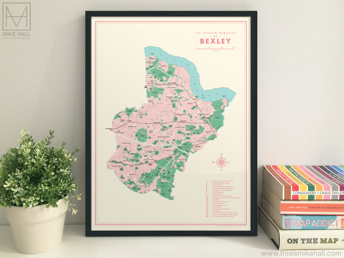
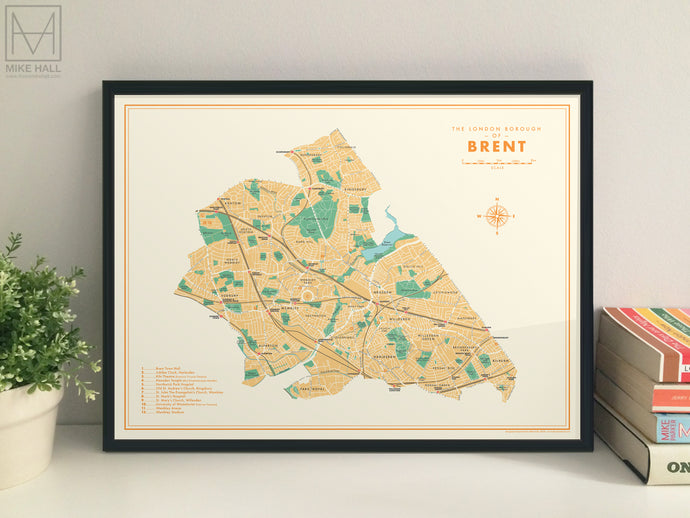
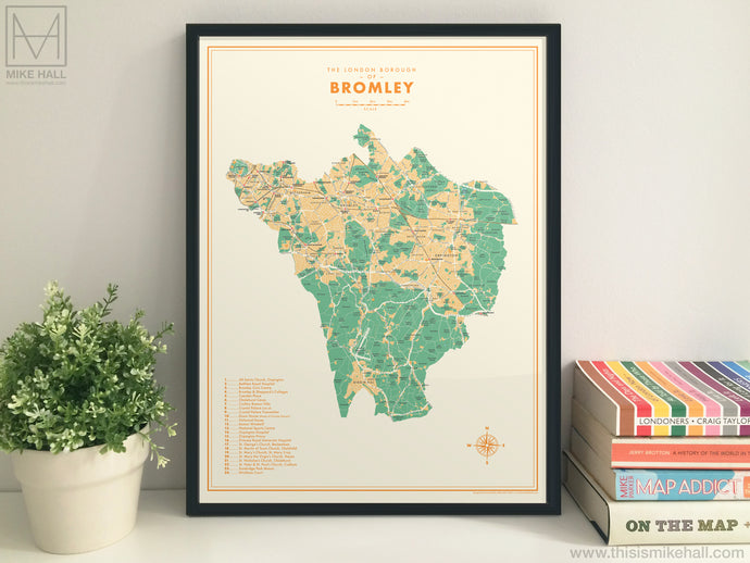
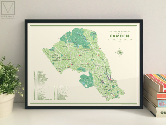
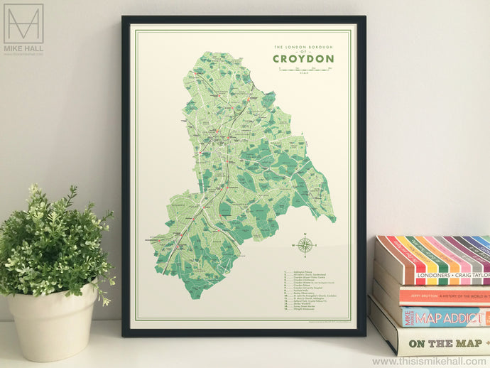
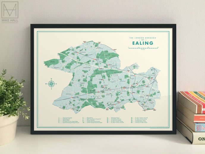
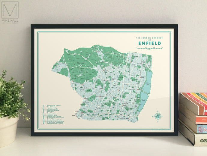
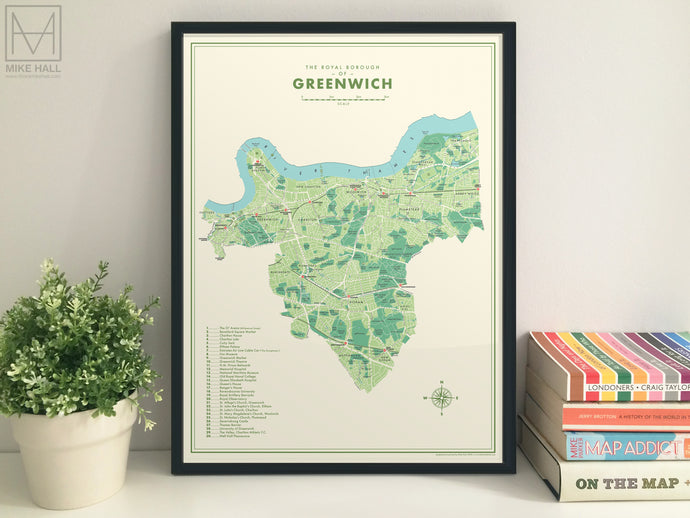
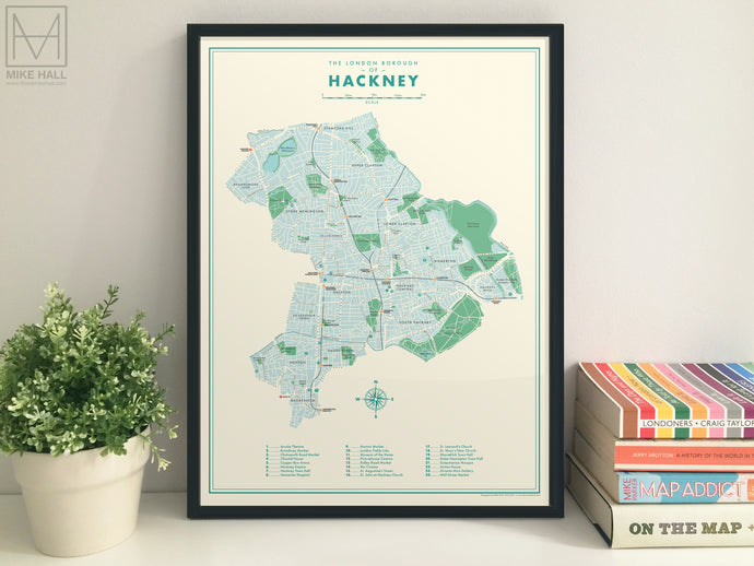
Retro London Boroughs: The Complete Collection
The full collection of all 32 Retro London Borough maps, plus a free bonus map of the City of London.


Historic Counties of England & Wales
A detailed map inspired by antique prints combining the historic county boundaries with modern detail. A map of Scotland is also available.

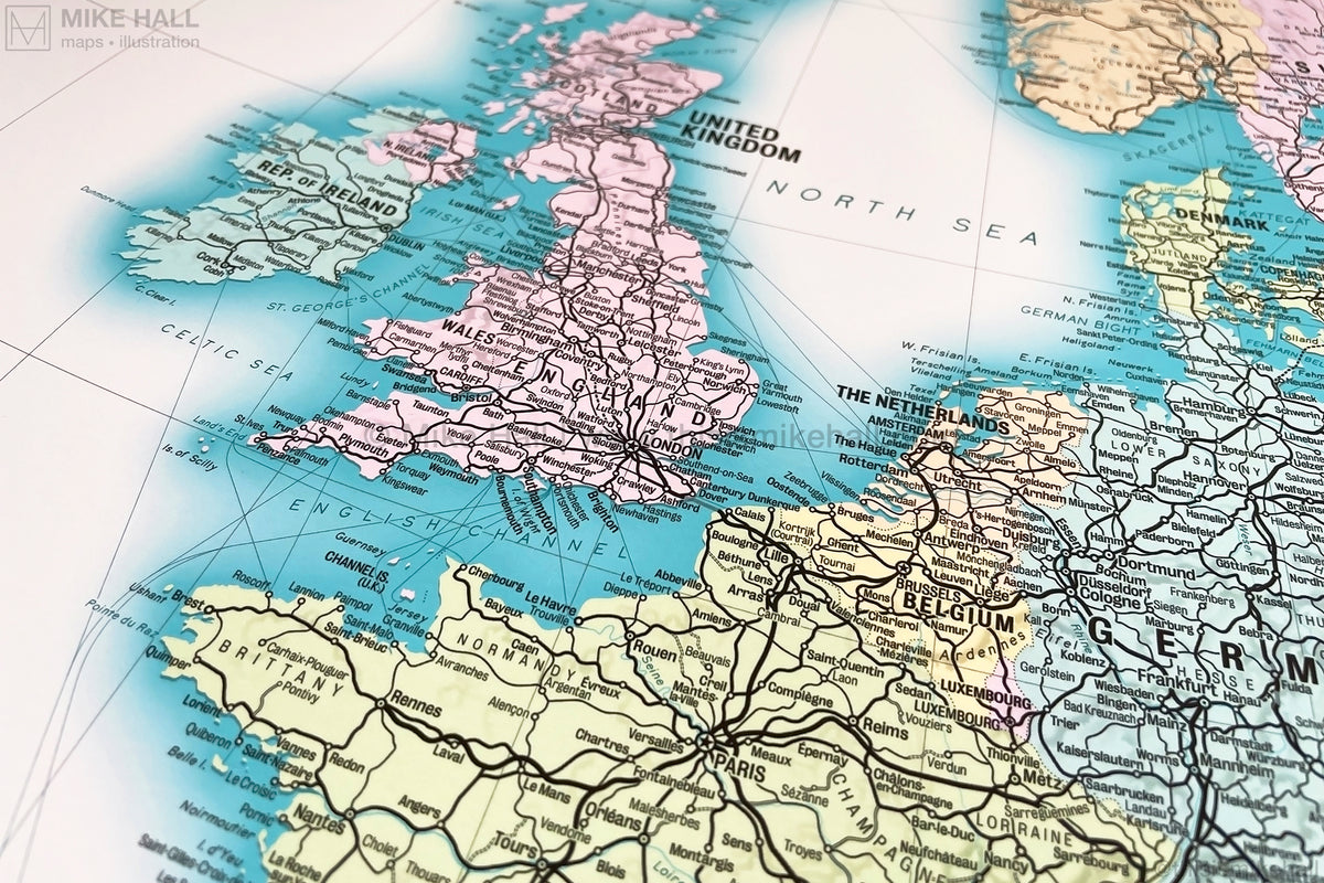
Railway Map of Europe
A unique and detailed map of the present-day railway network in Europe, inspired by vintage maps prints. Includes enlargements of ten major cities.

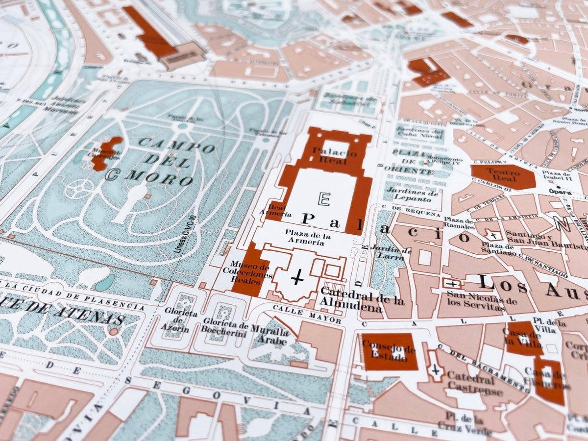
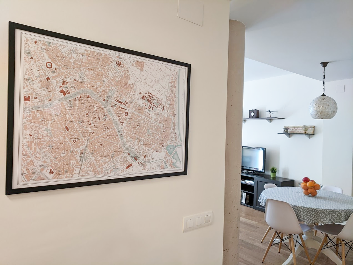
Vintage Style Map of Madrid, Spain
The latest addition to the City Maps collection is an original and highly detailed plan of the city centre of the Spanish capital inspired by vintage maps.
Featured collection: Retro Boroughs of London


Guide to framing and print care
Read Mike's tips on how to frame and care for your print to ensure the best display results and longetivity.