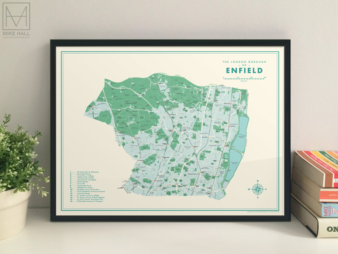
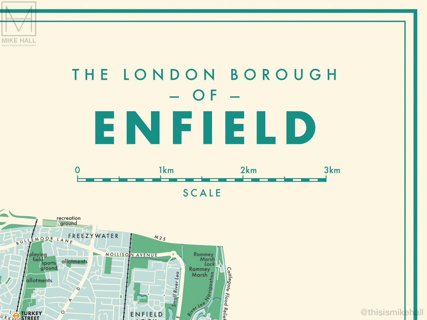
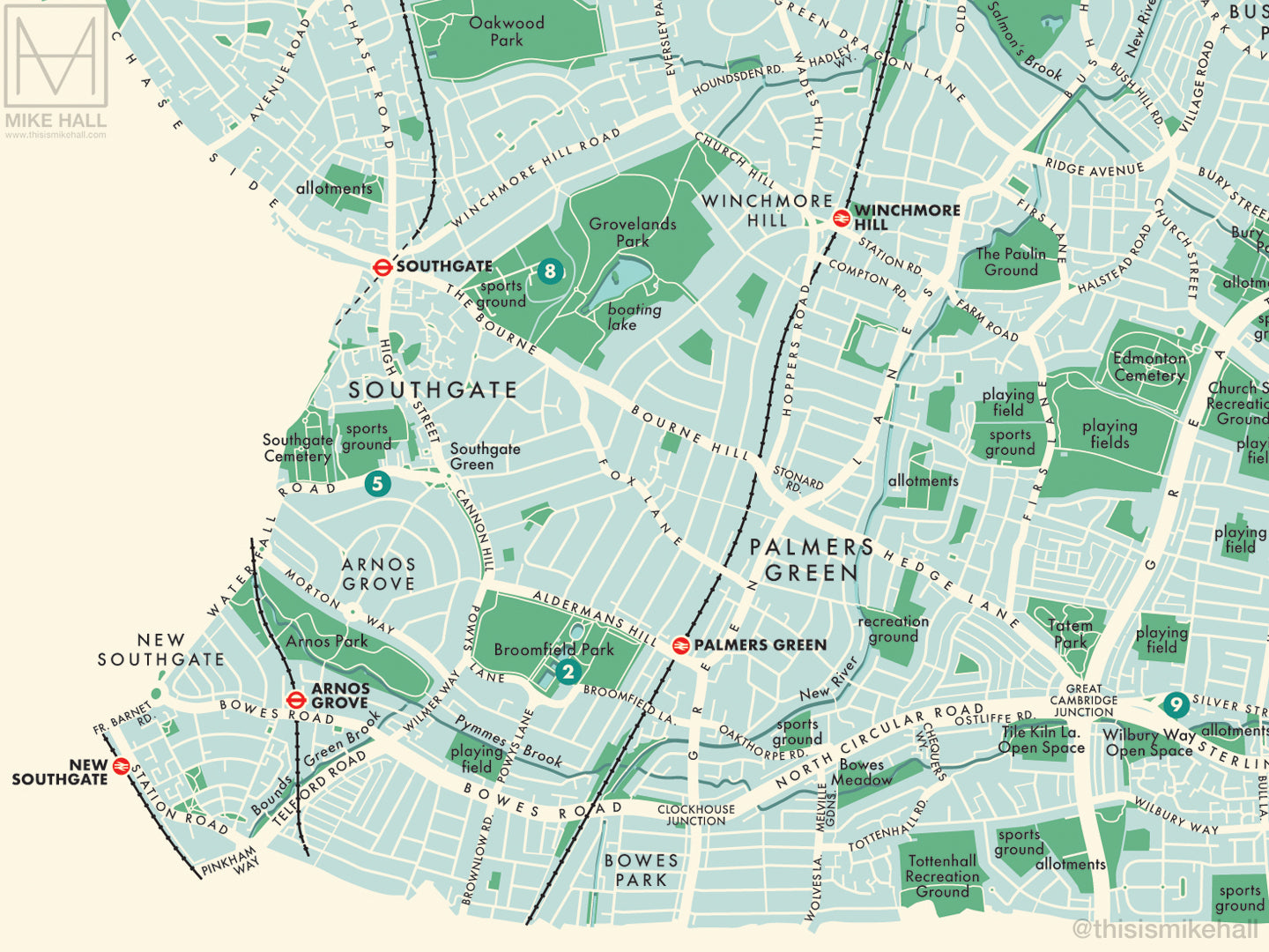
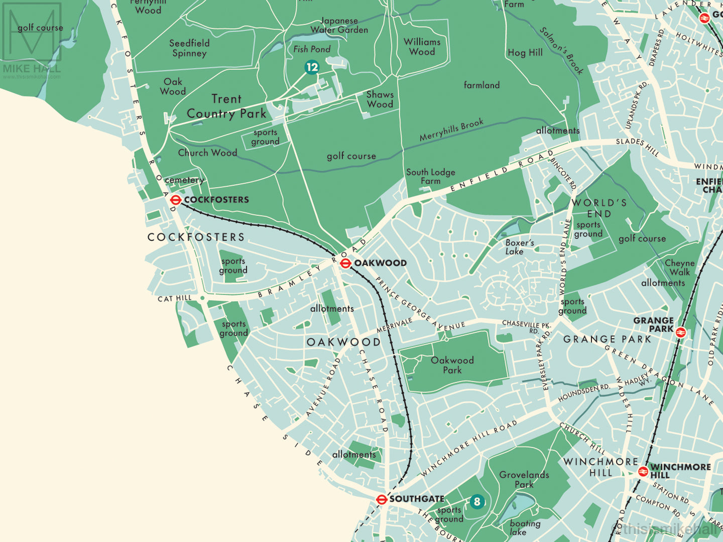
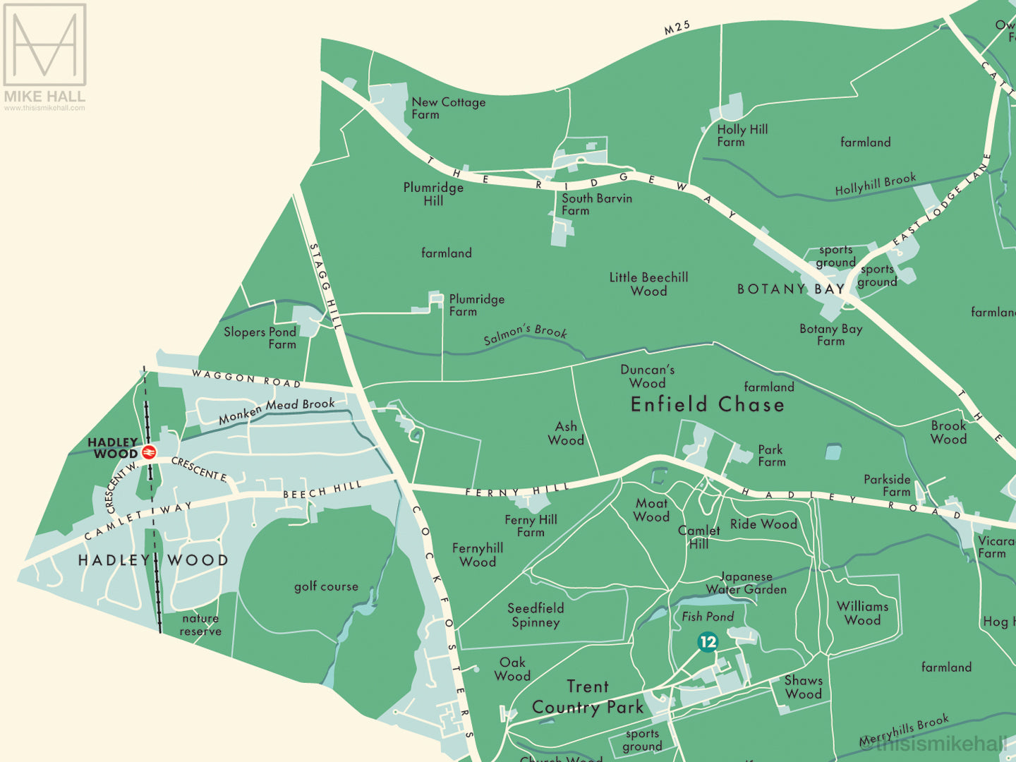
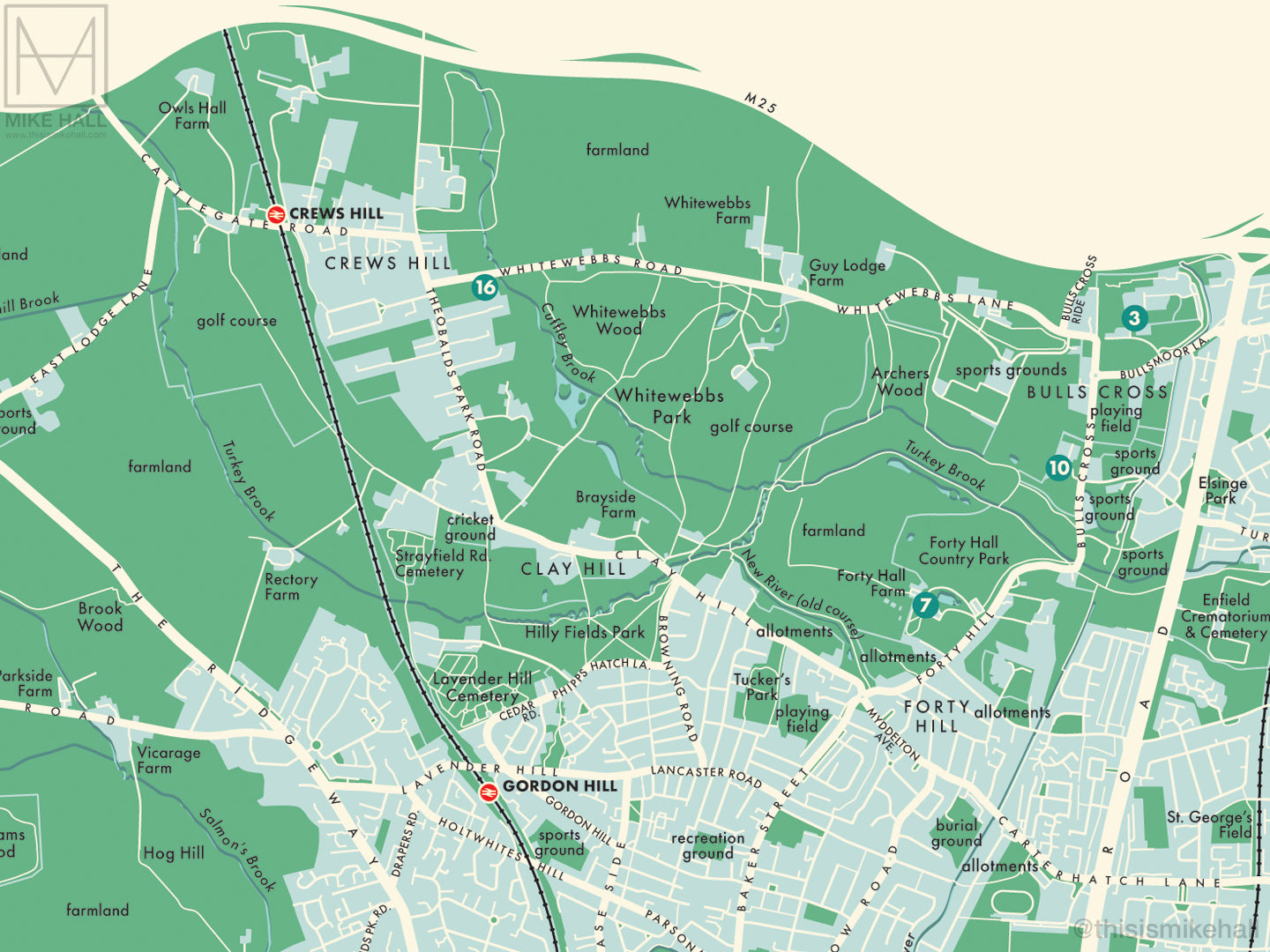
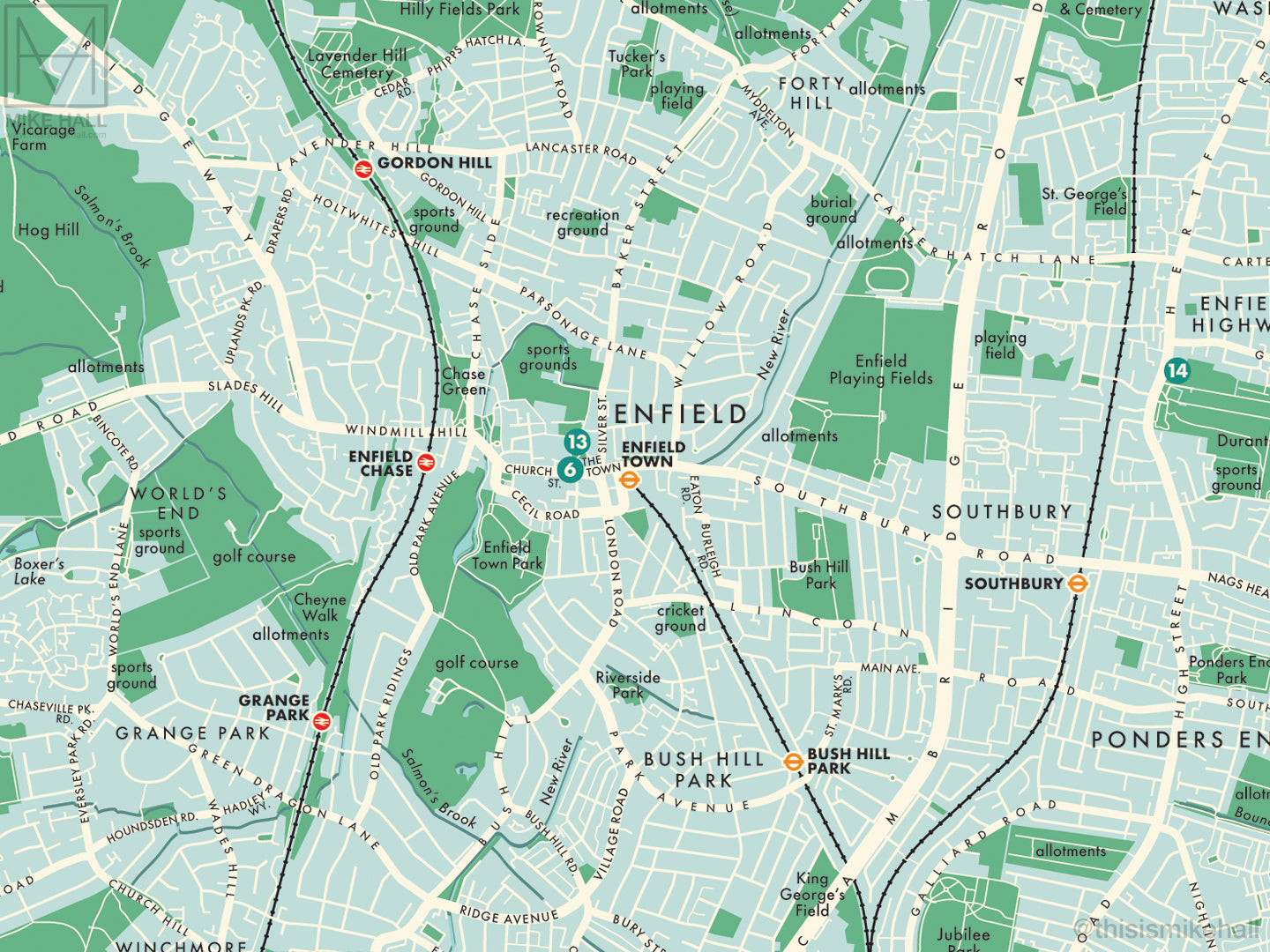
This is an original map of Enfield, a borough of London, UK, inspired by colourful, modernist graphic design of the 1950s and 1960s.
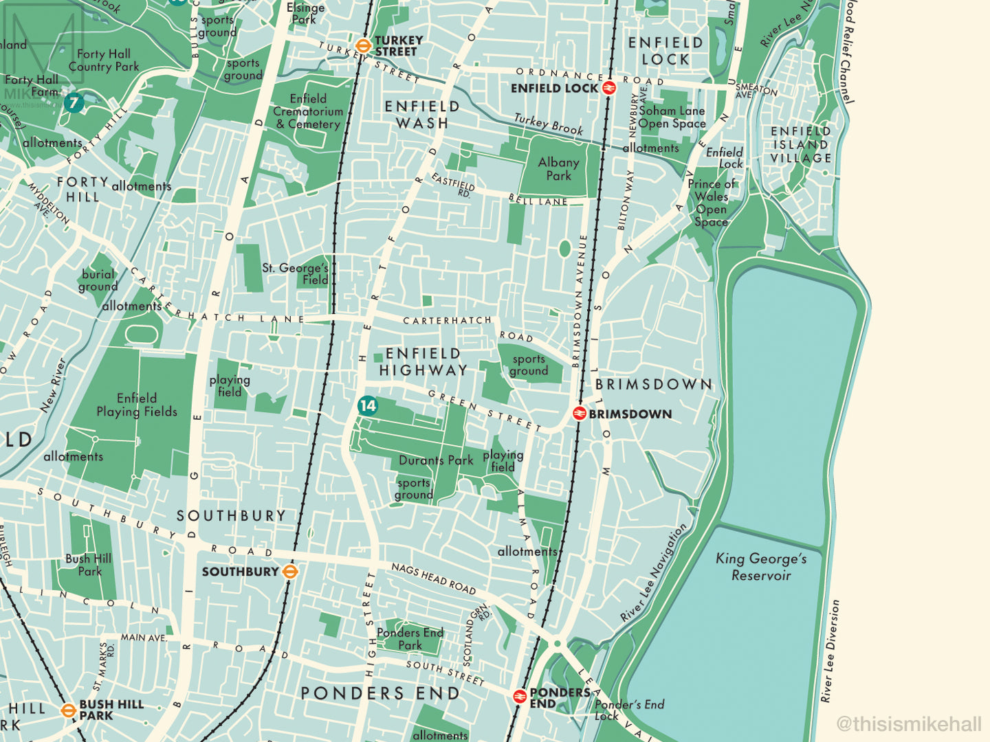
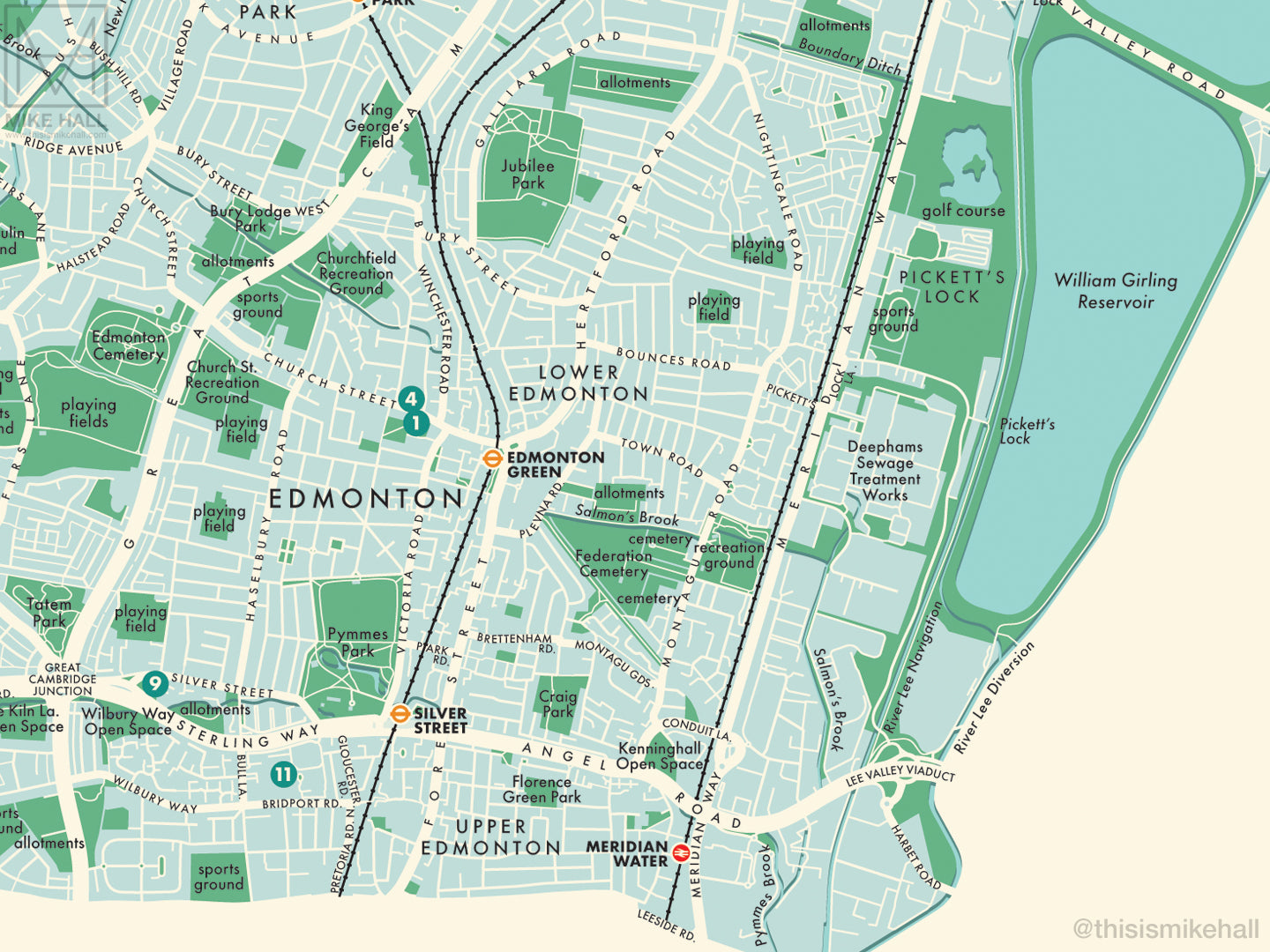
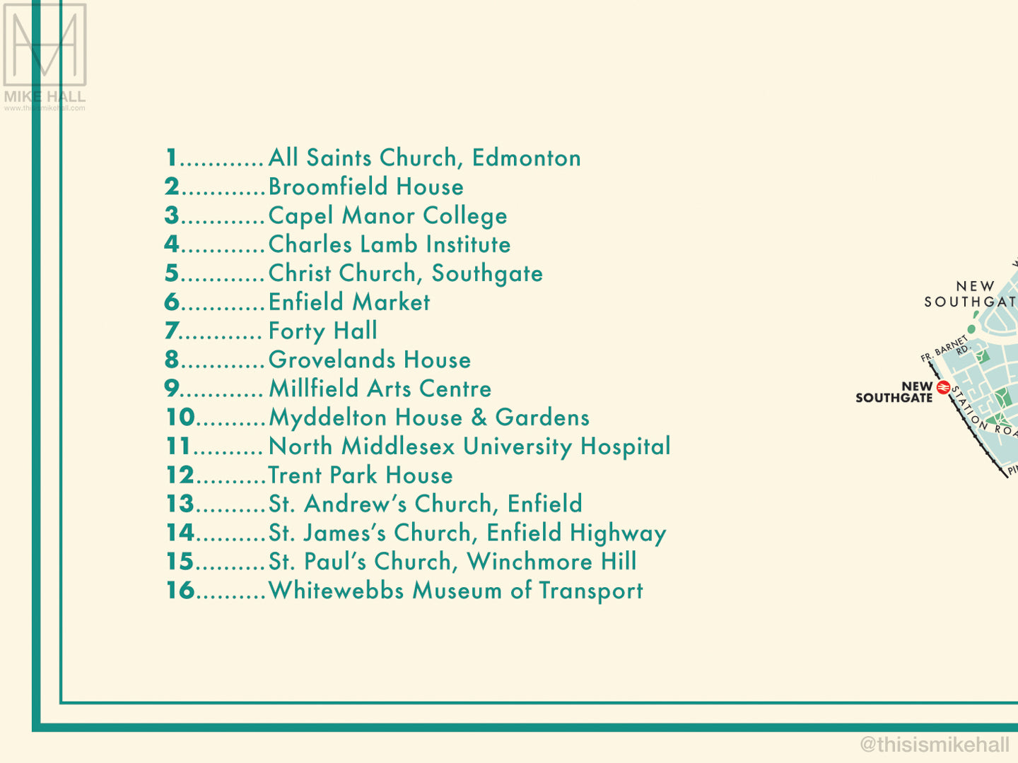
The design features a simple decoration scheme with notable landmarks (pinpointed with numbered circles on the map) listed alphanumerically to one side.
All local railway and London Underground stations are marked, and districts covered by the map include Arnos Grove, Botany Bay, Bowes Park, Brimsdown, Bulls Cross, Bush Hill Park, Clay Hill, Cockfosters, Crews Hill, Edmonton, Enfield Chase, Enfield Highway, Enfield Island Village, Enfield Lock, Enfield Town, Enfield Wash, Forty Hill, Freezywater, Gordon Hill, Grange Park, Hadley Wood, Lower Edmonton, Meridian Water, New Southgate, Oakwood, Palmers Green, Pickett's Lock, Ponders End, Southbury, Southgate, Upper Edmonton, Winchmore Hill and World's End.
- High quality digital giclee print on archival paper
- Available in three size variations: choose from the menu above
- Signed in pencil by the artist, with a stamp of authenticity on the rear
- Open edition - printed to order
- Frame NOT included
Carefully packaged and delivered in a firm cardboard tube.