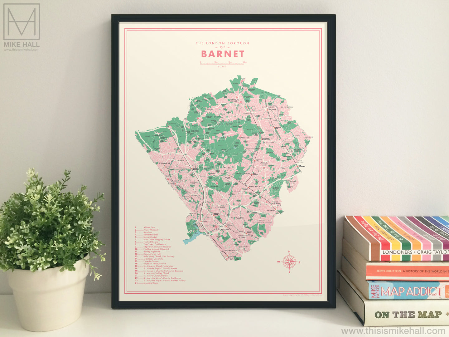
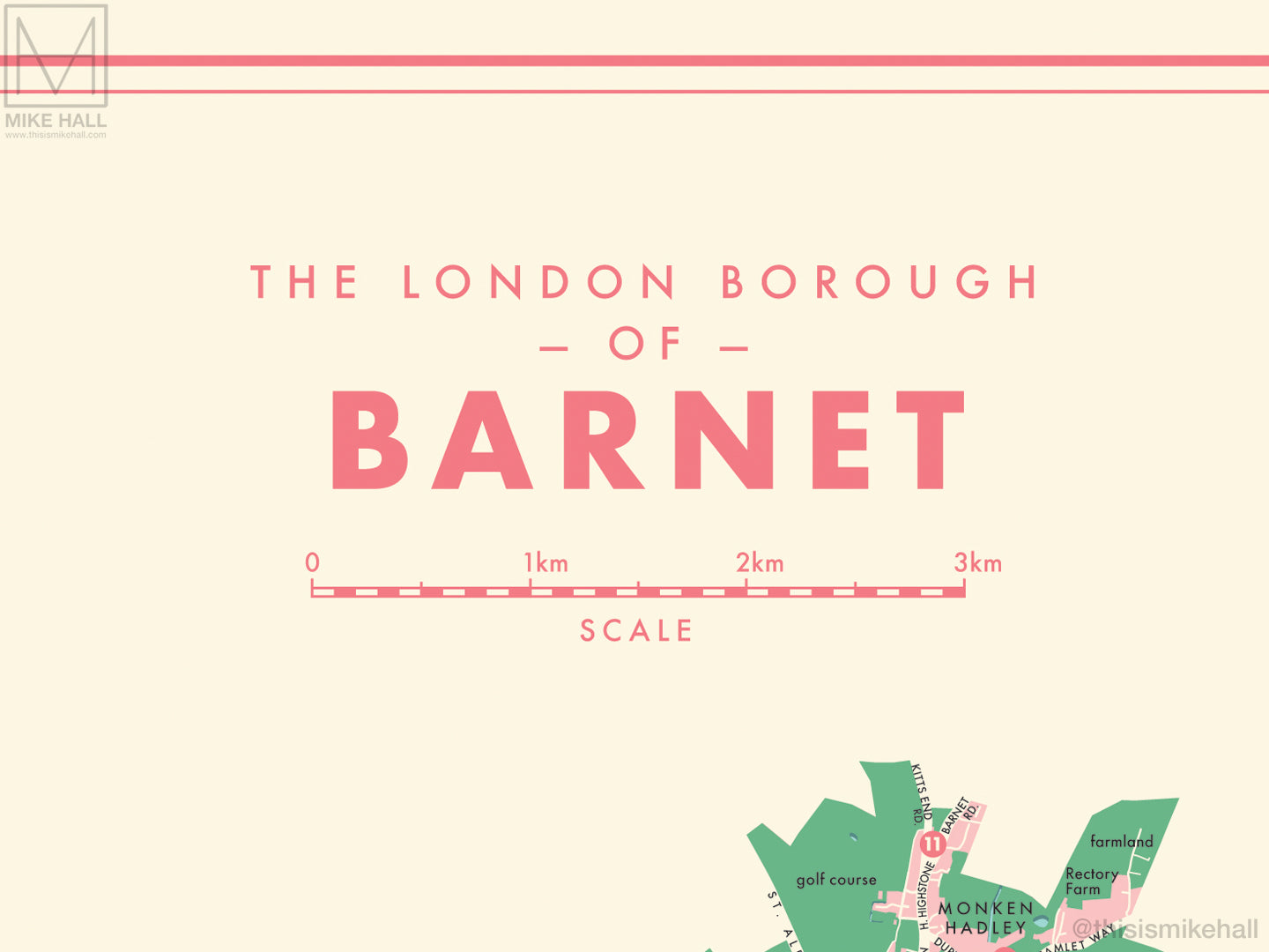
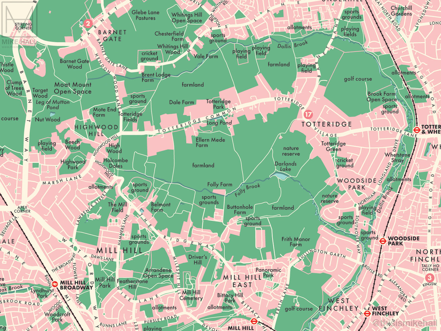
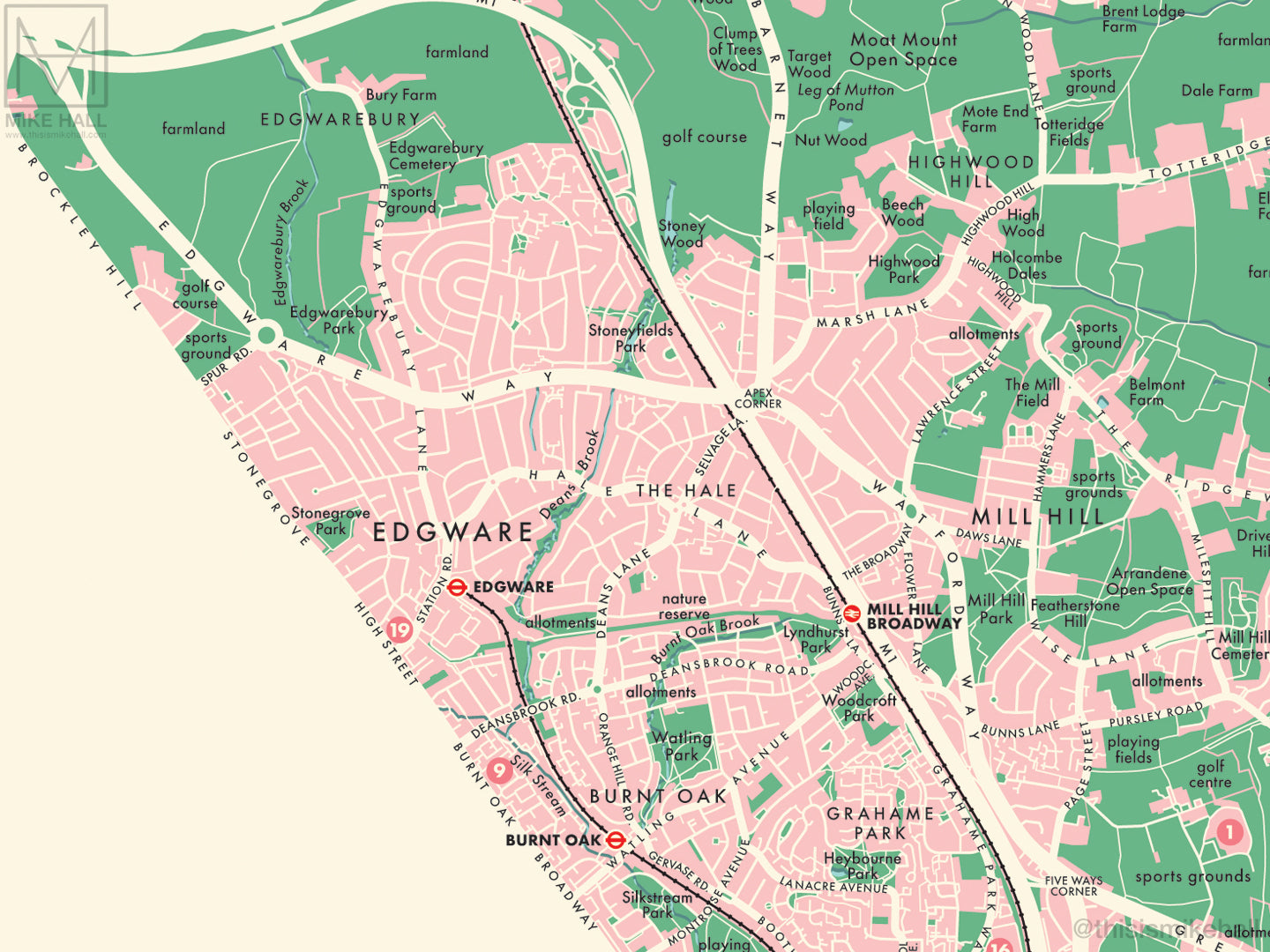
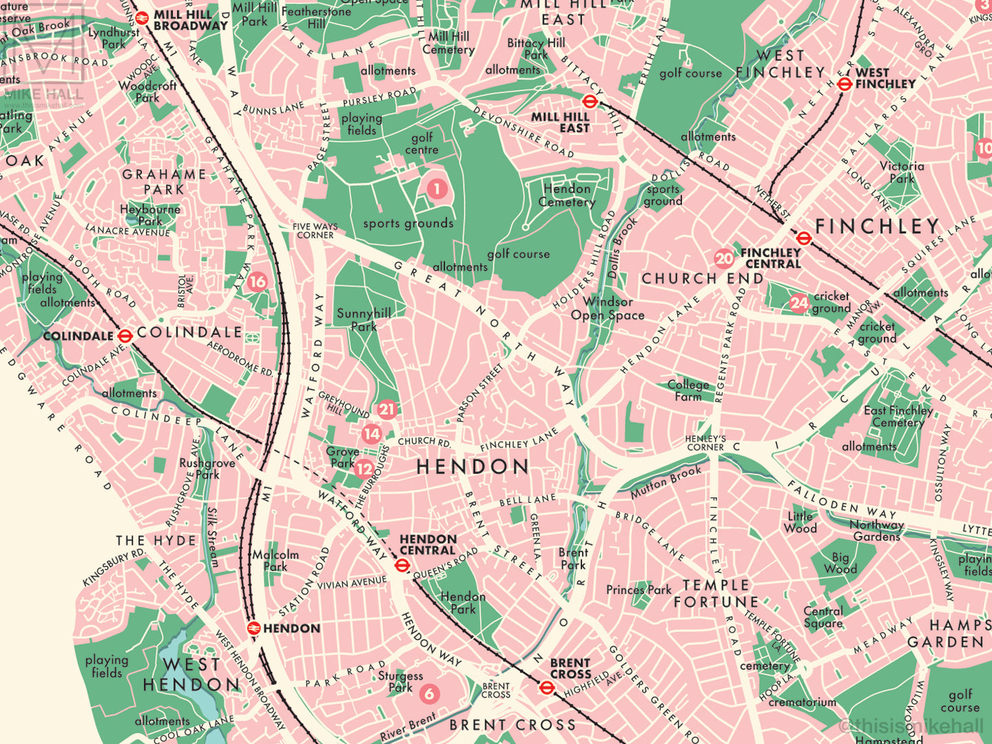
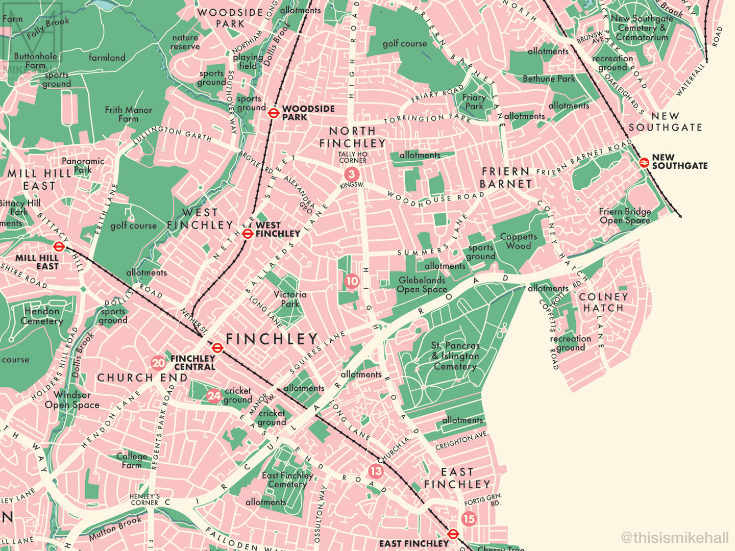
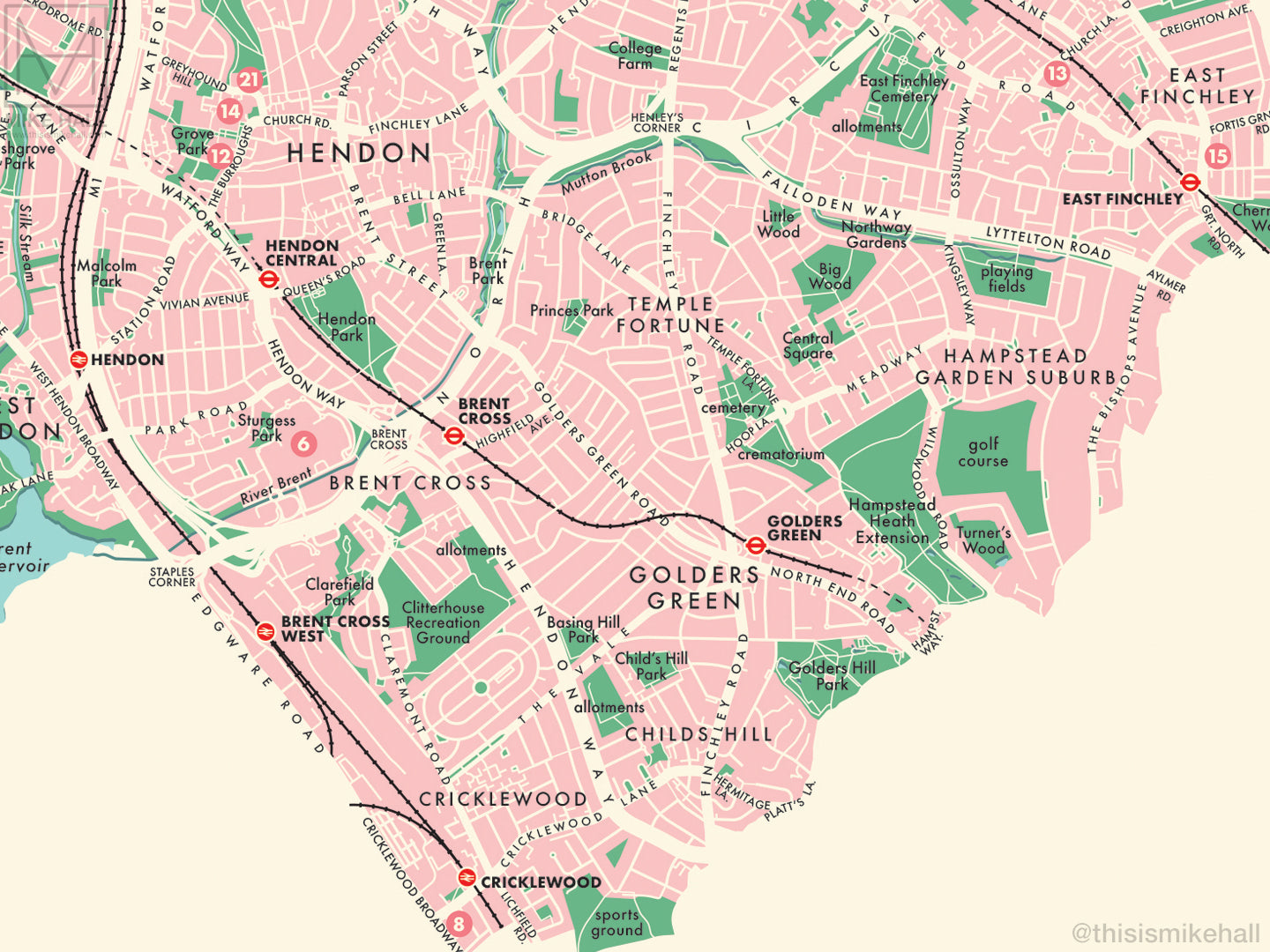
This is an original map of Barnet, a borough of London, UK, inspired by colourful, modernist graphic design of the 1950s and 1960s.
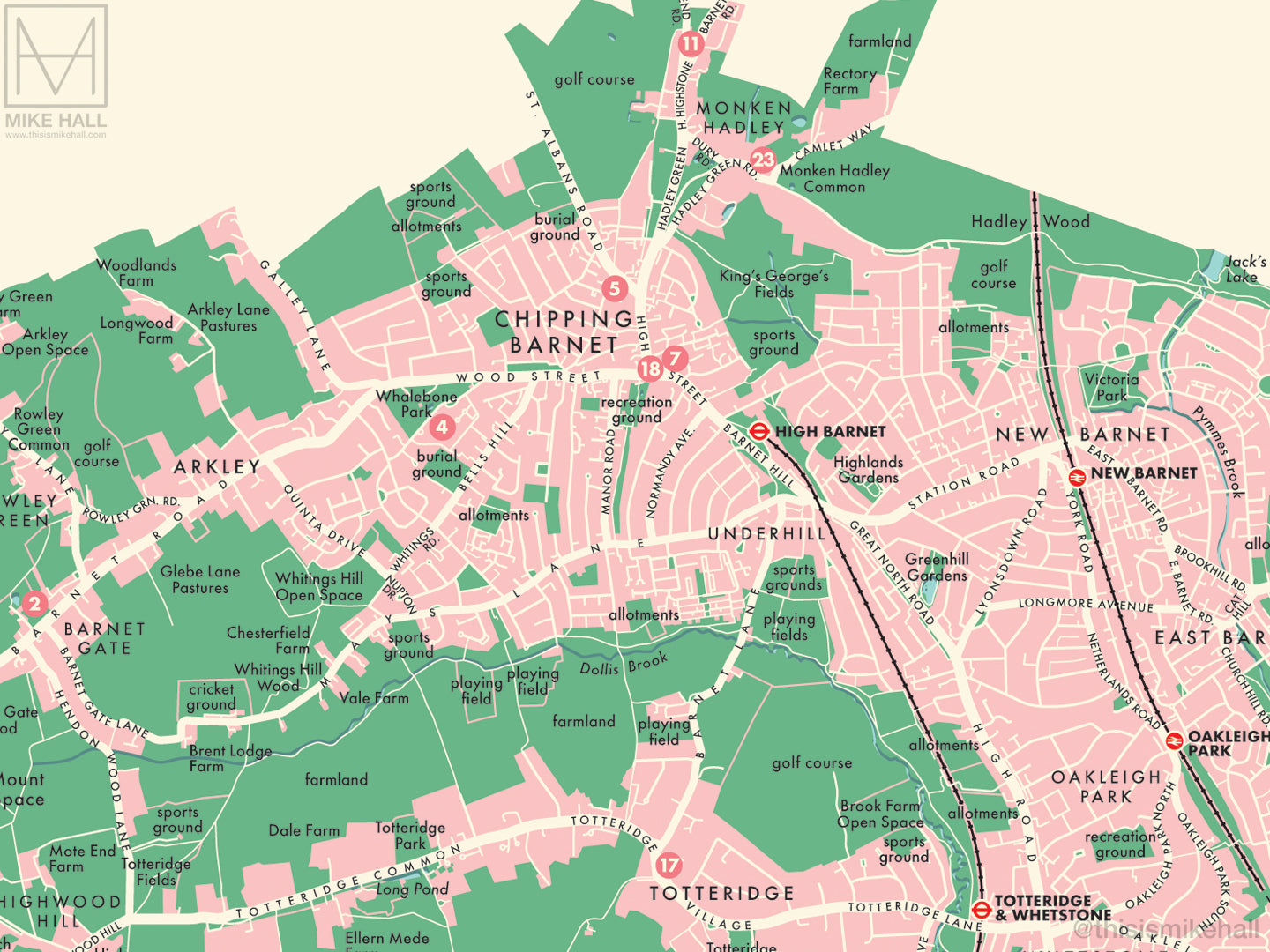
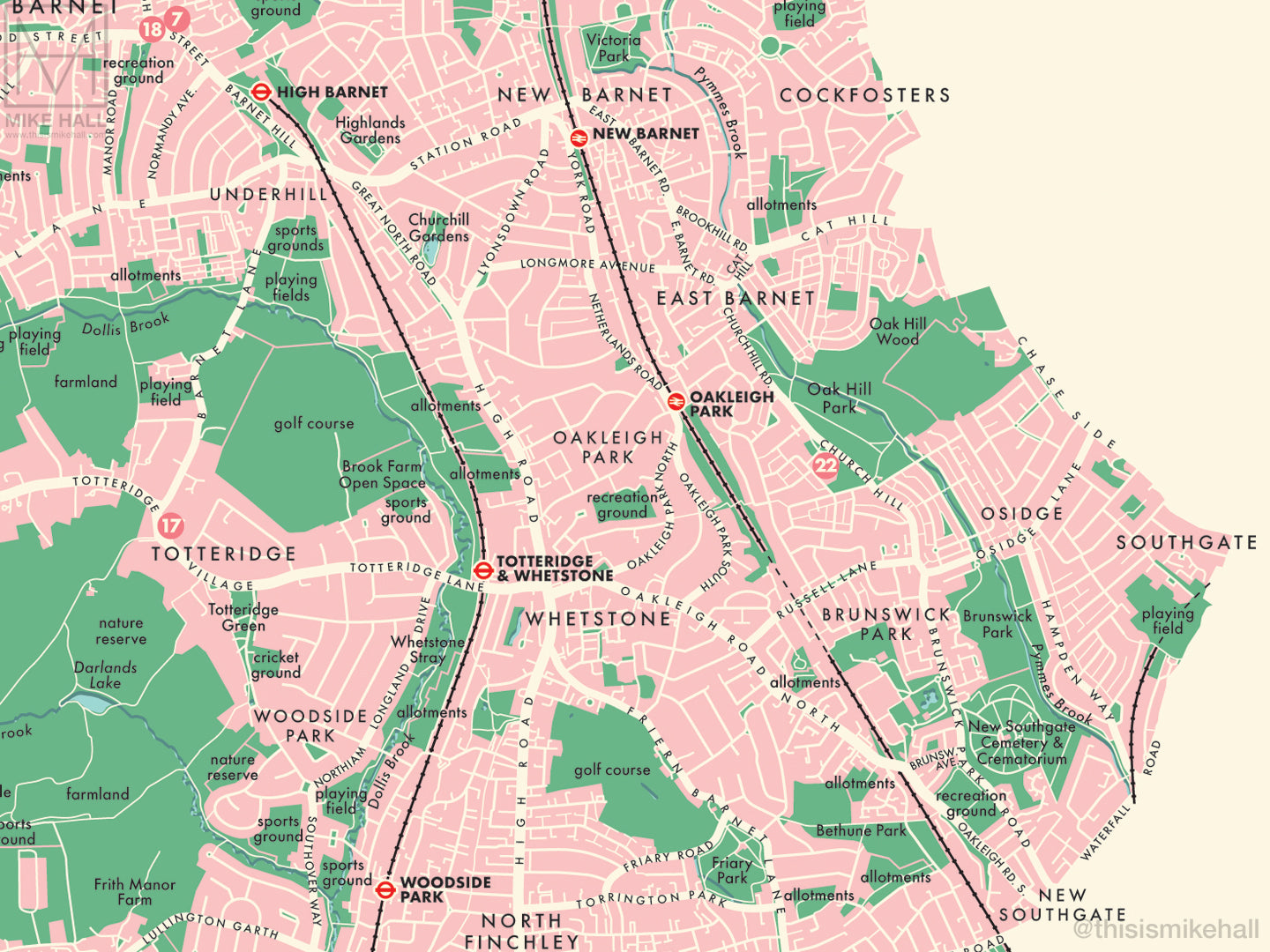
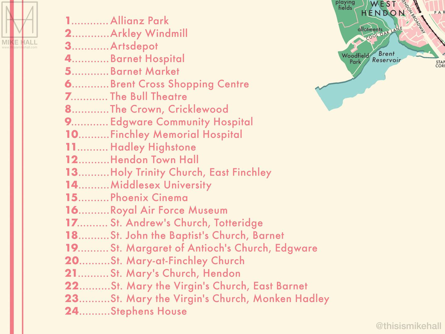
The design features a simple decoration scheme with notable landmarks (pinpointed with numbered circles on the map) listed alphanumerically to one side.
All local railway stations are marked, and districts covered by the map include Arkley, Brent Cross, Brunswick Park, Burnt Oak, Chipping Barnet or High Barnet, Childs Hill, Colindale, Cricklewood, East Barnet, East Finchley, Edgware, Finchley Central, Friern Barnet, Golders Green, Grahame Park, Hampstead Garden Suburb, Hendon, Mill Hill, Mill Hill East, Monken Hadley, New Barnet, Oakleigh Park, Rowley Green, Temple Fortune, Totteridge, West Finchley, West Hendon, Whetstone and Woodside Park.
- High quality digital giclee print on archival paper
- Available in three size variations: choose from the menu above
- Signed in pencil by the artist, with a stamp of authenticity on the rear
- Open edition - printed to order
- Frame NOT included
Carefully packaged and delivered in a firm cardboard tube.