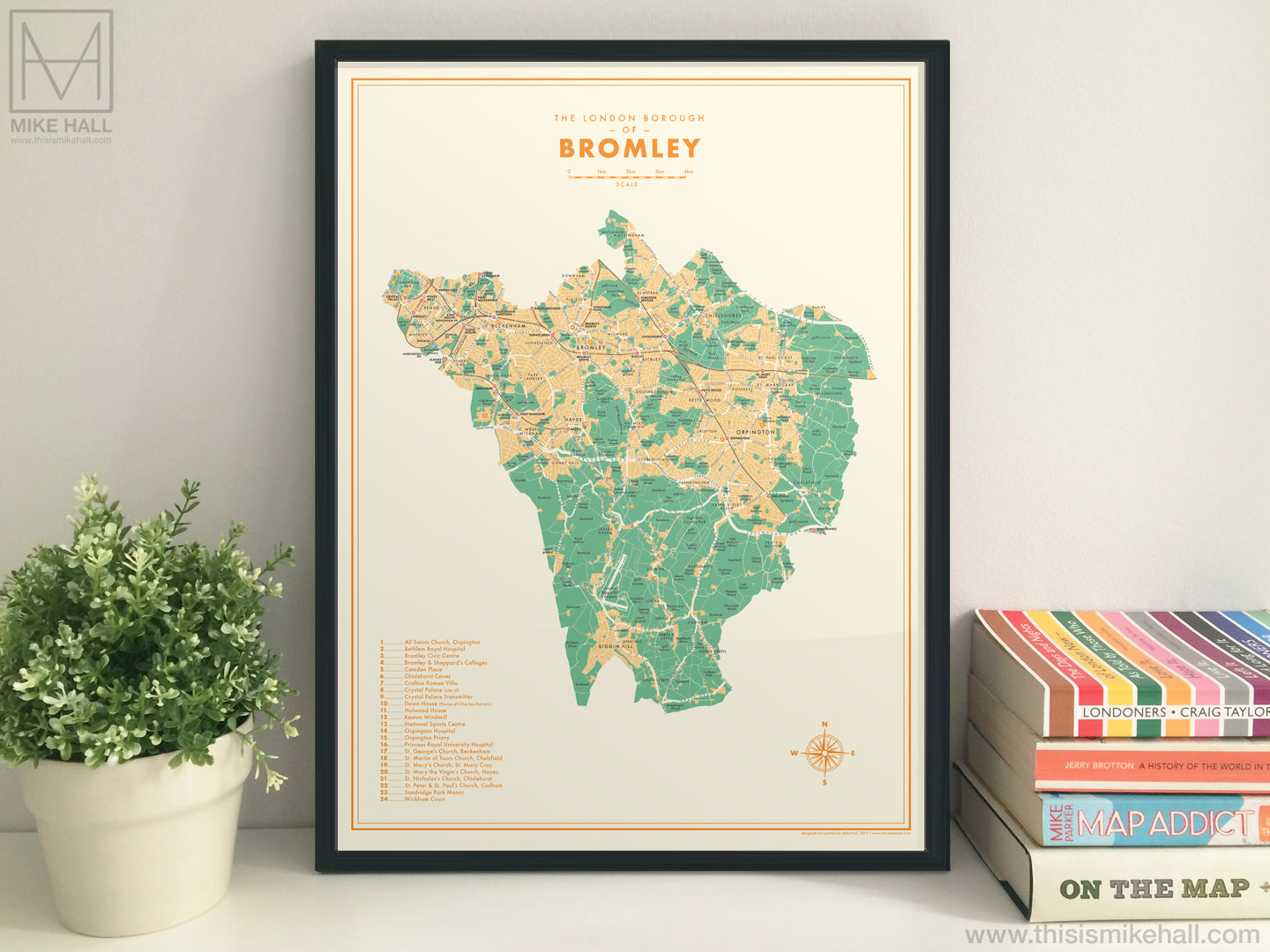
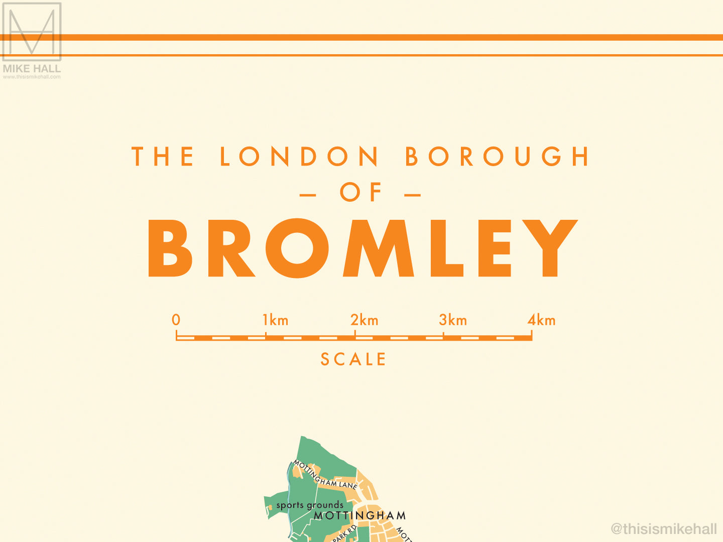
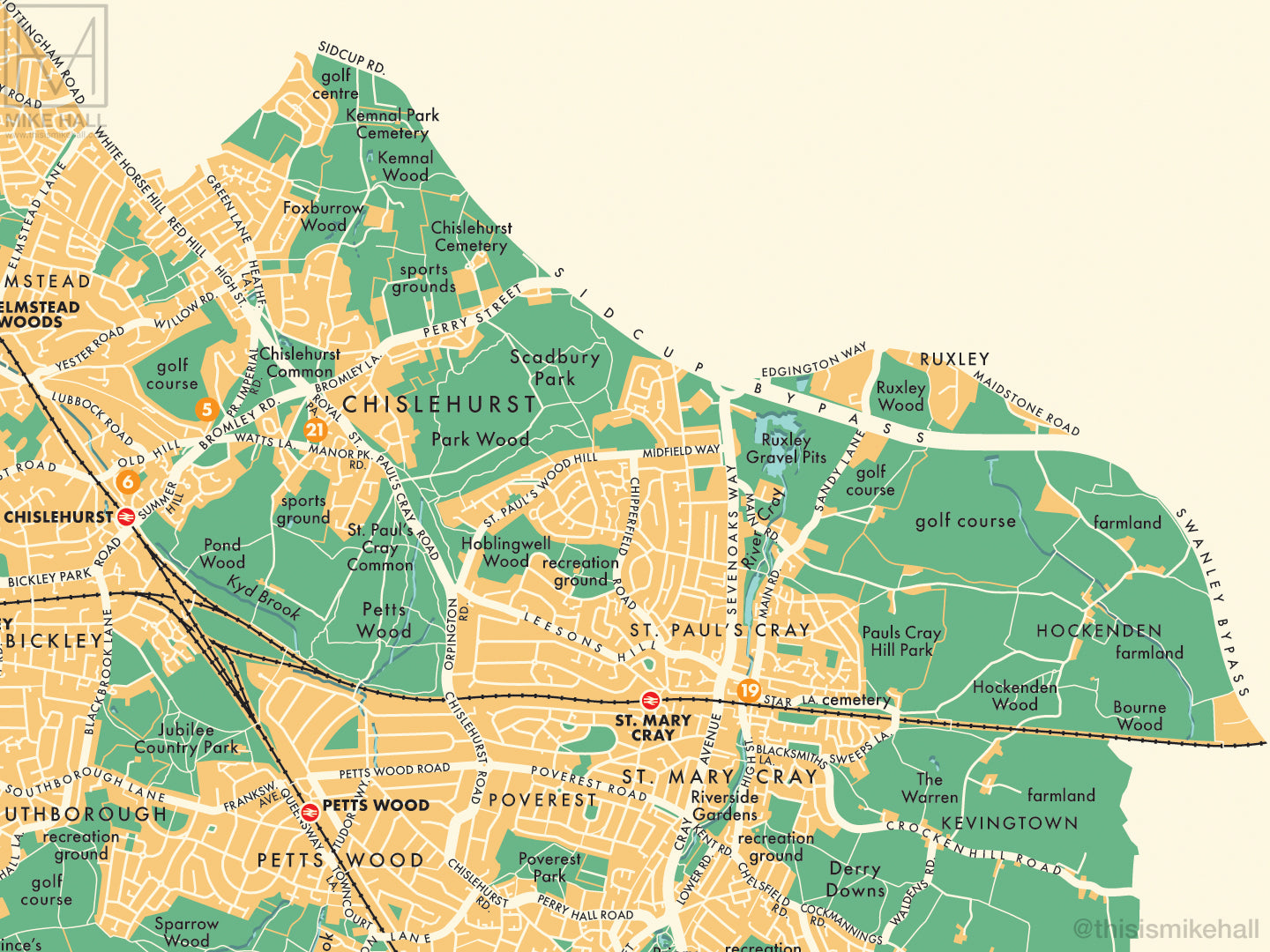
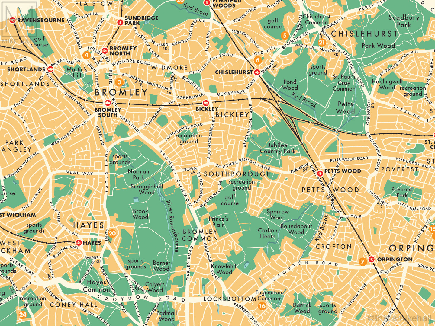
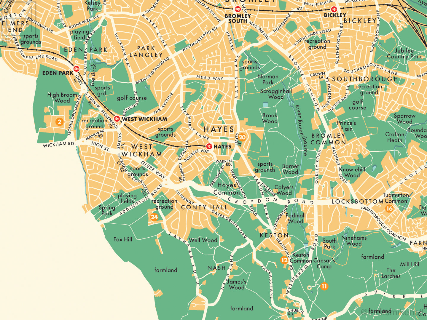
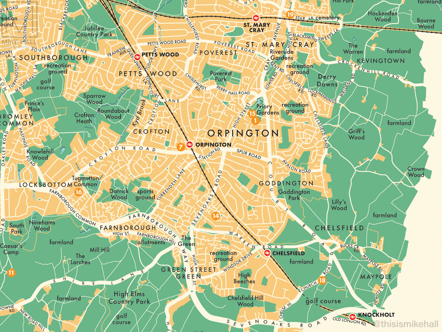
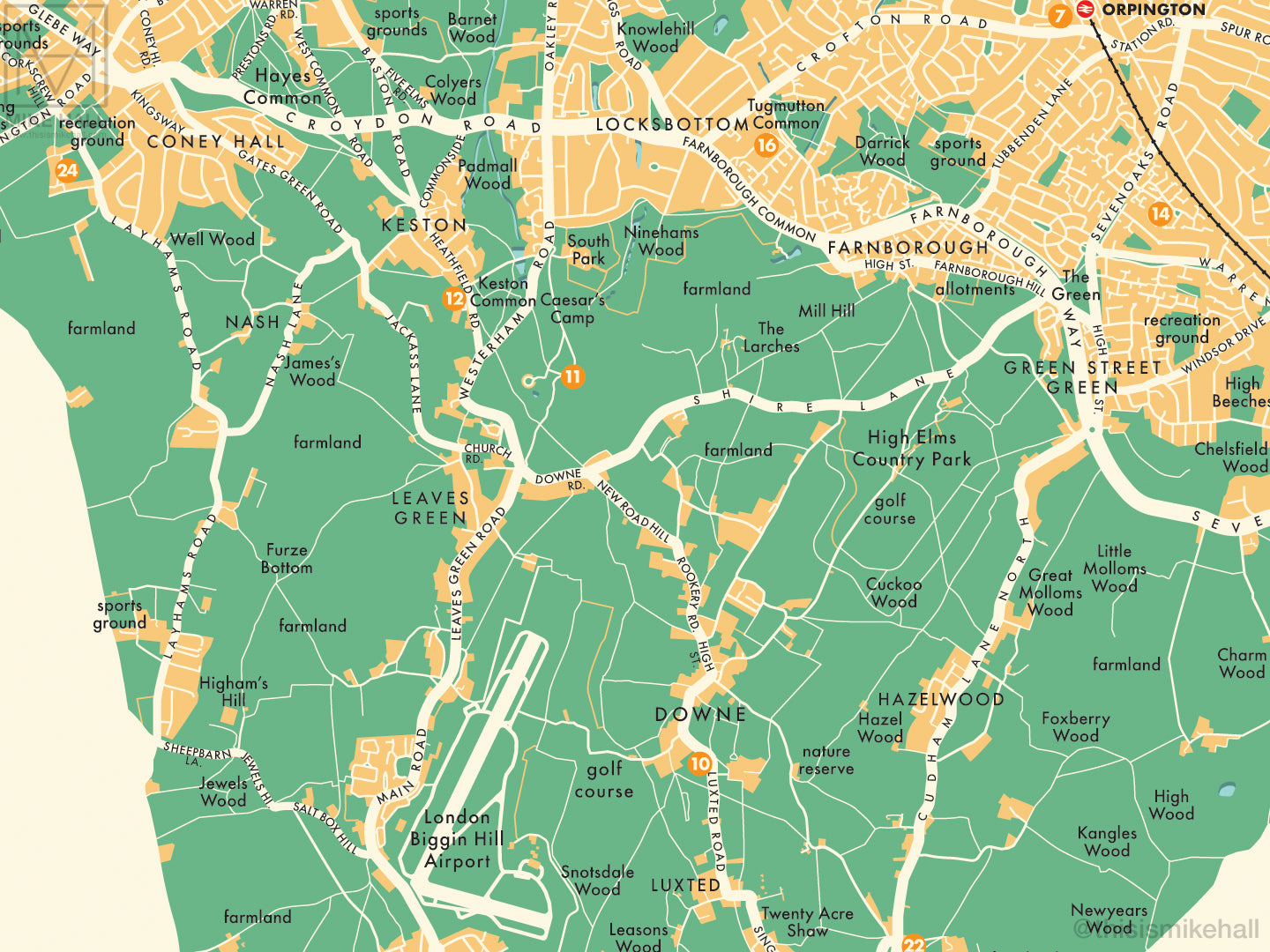
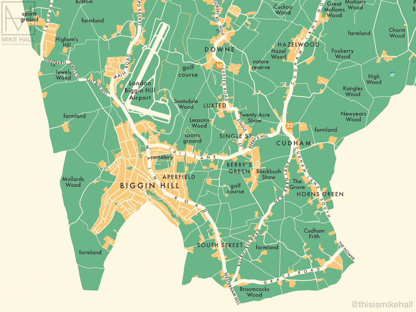
This is an original map of Bromley, a borough of London, UK, inspired by colourful, modernist graphic design of the 1950s and 1960s.
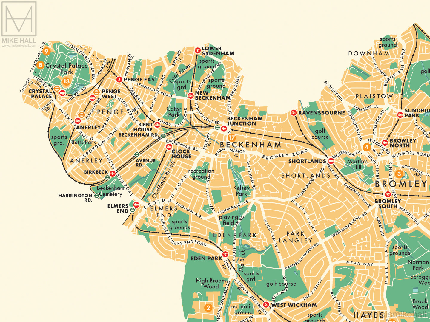
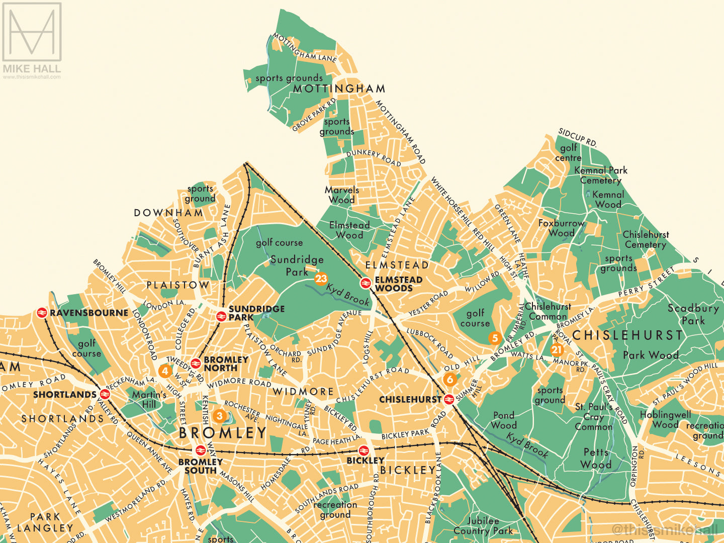
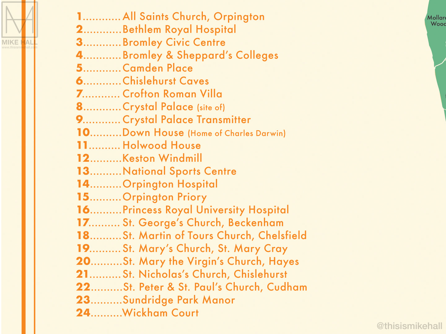
The design features a simple decoration scheme with notable landmarks (pinpointed with numbered circles on the map) listed alphanumerically to one side.
All local railway stations are marked, and districts covered by the map include Anerley, Beckenham, Bickley, Biggin Hill, Bromley, Chelsfield, Chislehurst, Crystal Palace, Cudham, Downe, Eden Park, Elmers End, Farnborough, Green Street Green, Hayes, Hockenden, Keston, Leaves Green, Locksbottom, Mottingham, New Beckenham, Orpington, Park Langley, Penge, Petts Wood, Plaistow, Pratt's Bottom, St. Mary Cray, St. Paul's Cray, Shortlands, Southborough, West Wickham and Widmore.
- High quality digital giclee print on archival paper
- Available in three size variations: choose from the menu above
- Signed in pencil by the artist, with a stamp of authenticity on the rear
- Open edition - printed to order
- Frame NOT included
Carefully packaged and delivered in a firm cardboard tube.