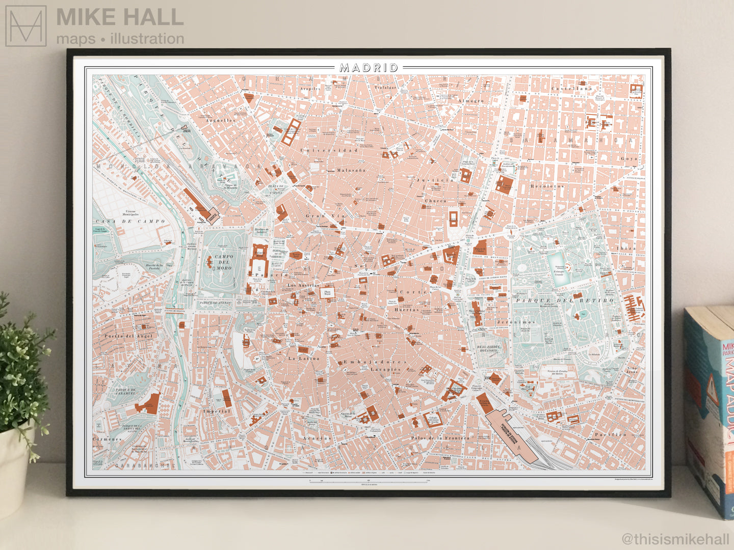
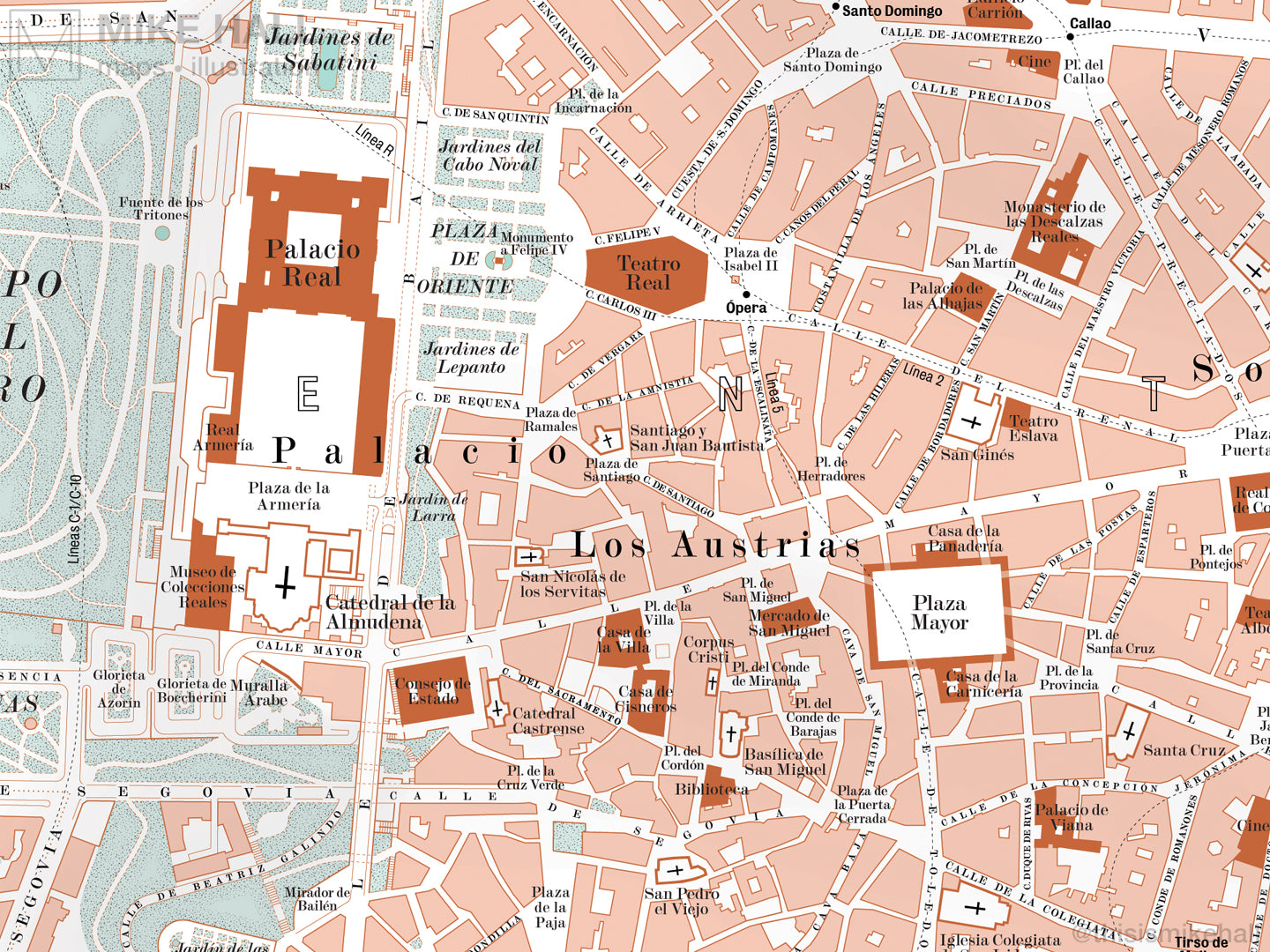
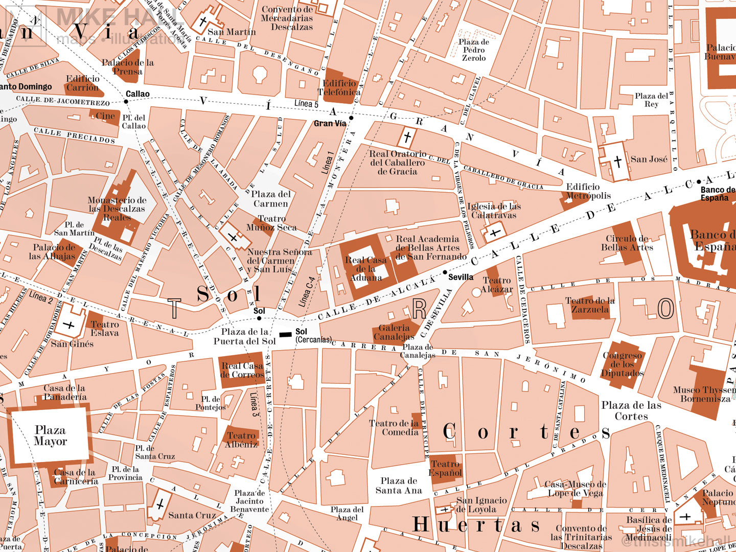
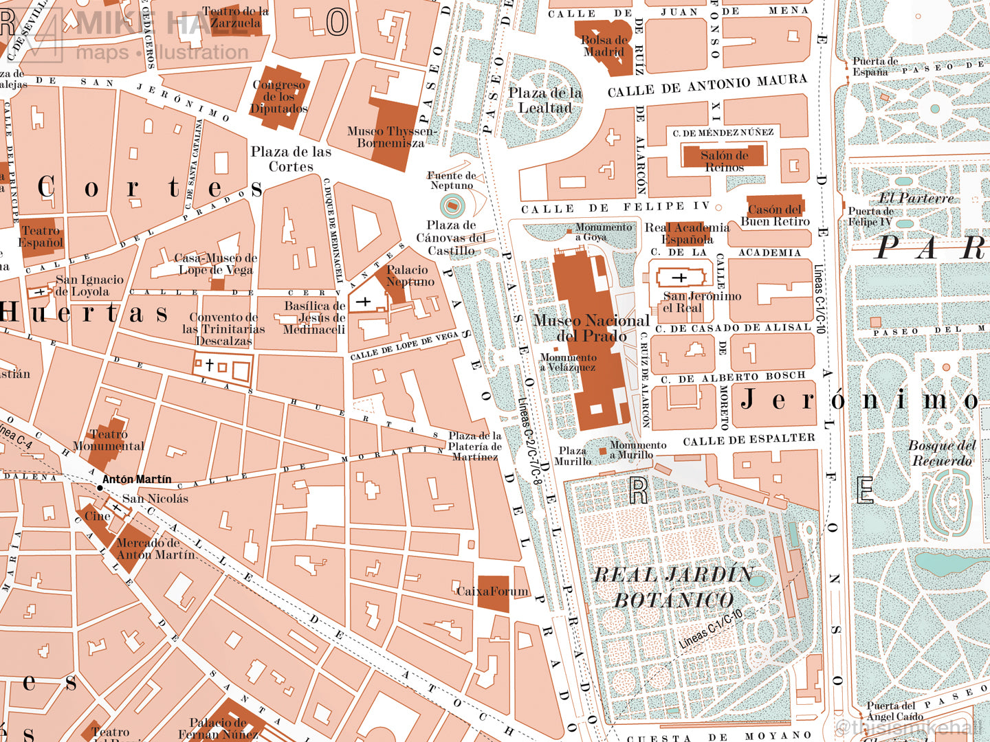
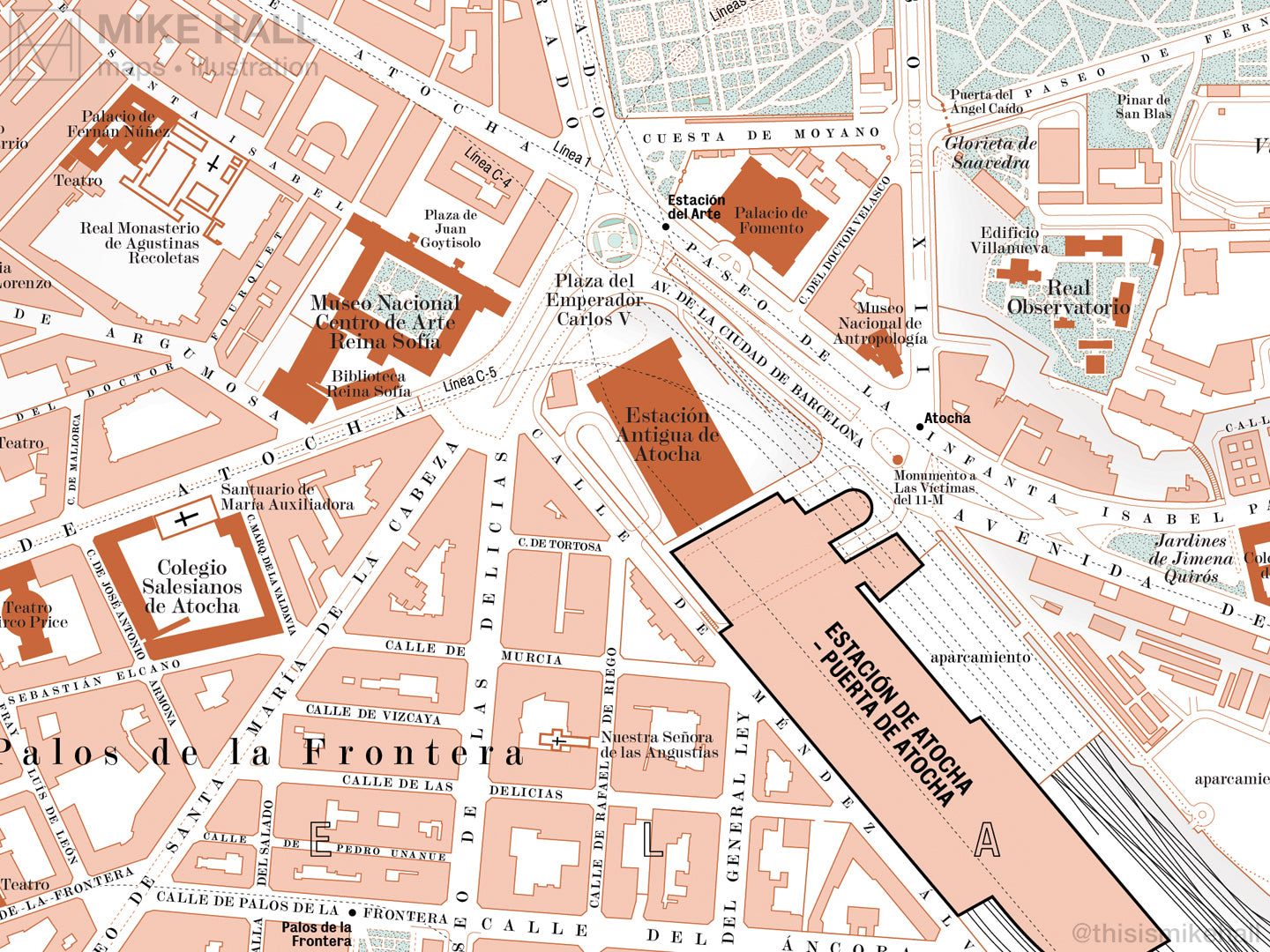
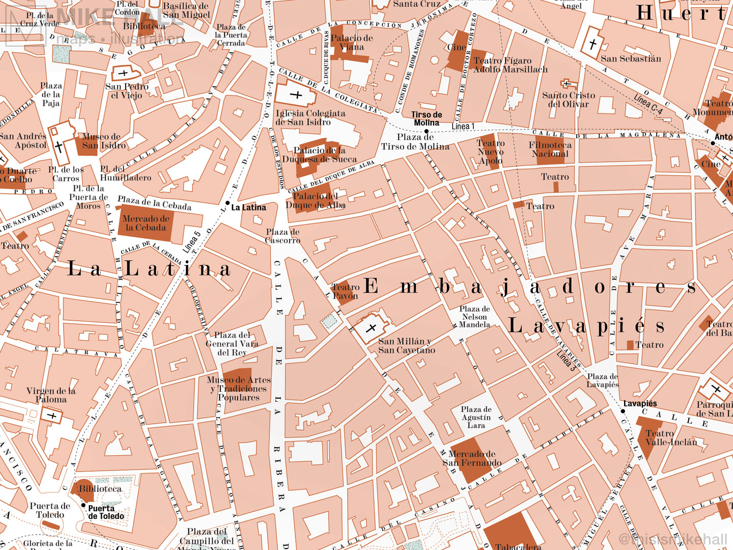
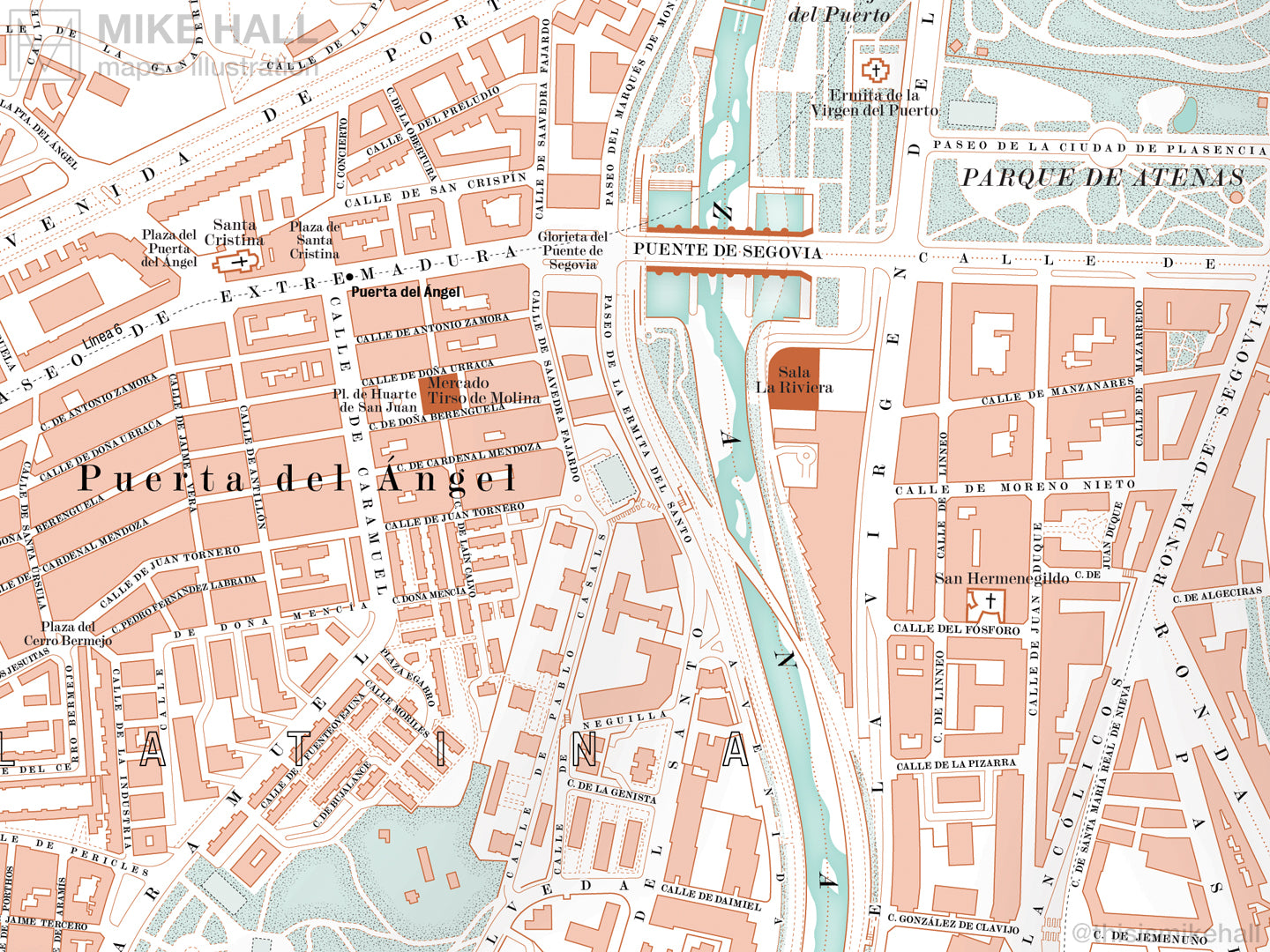
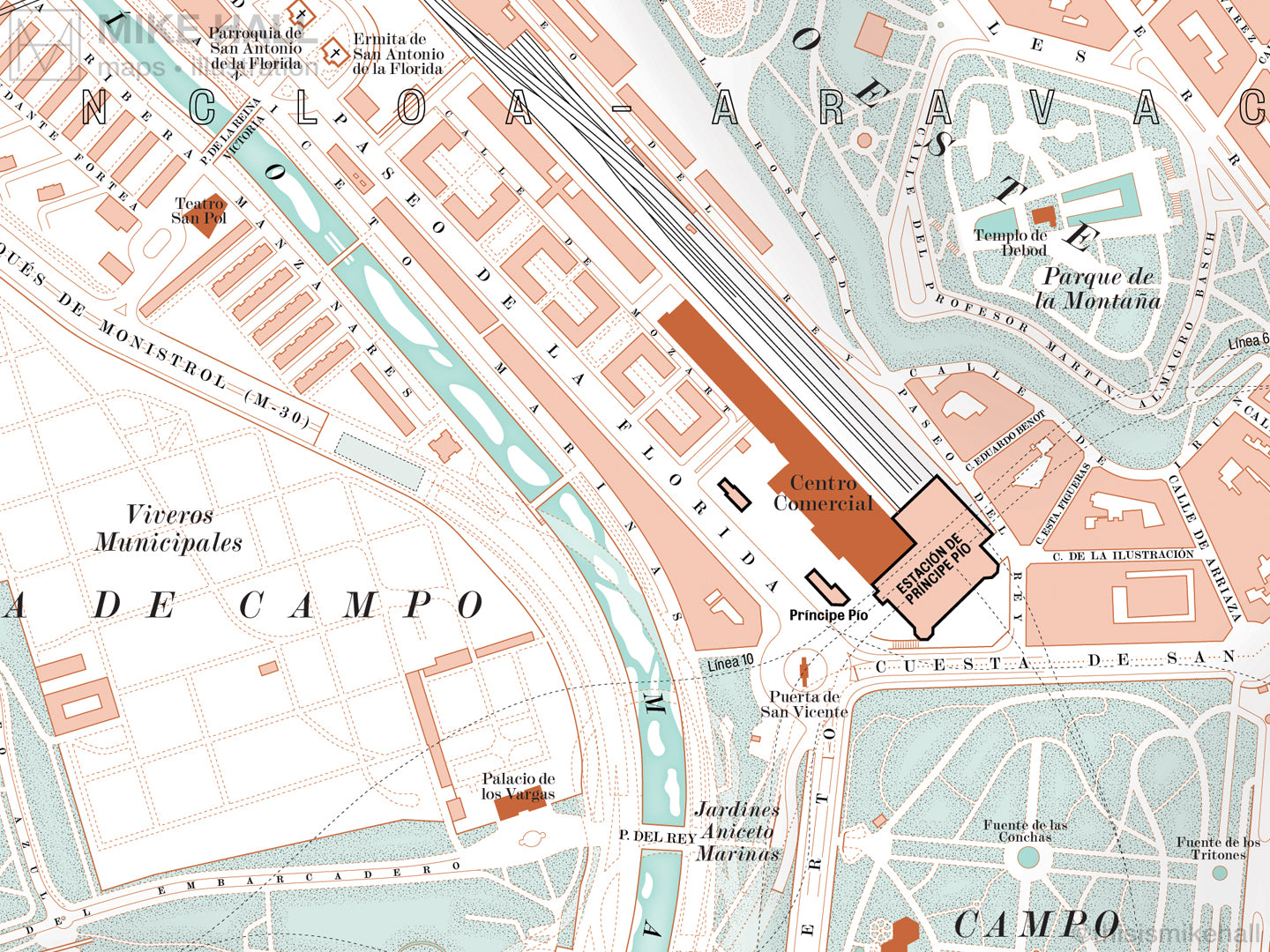
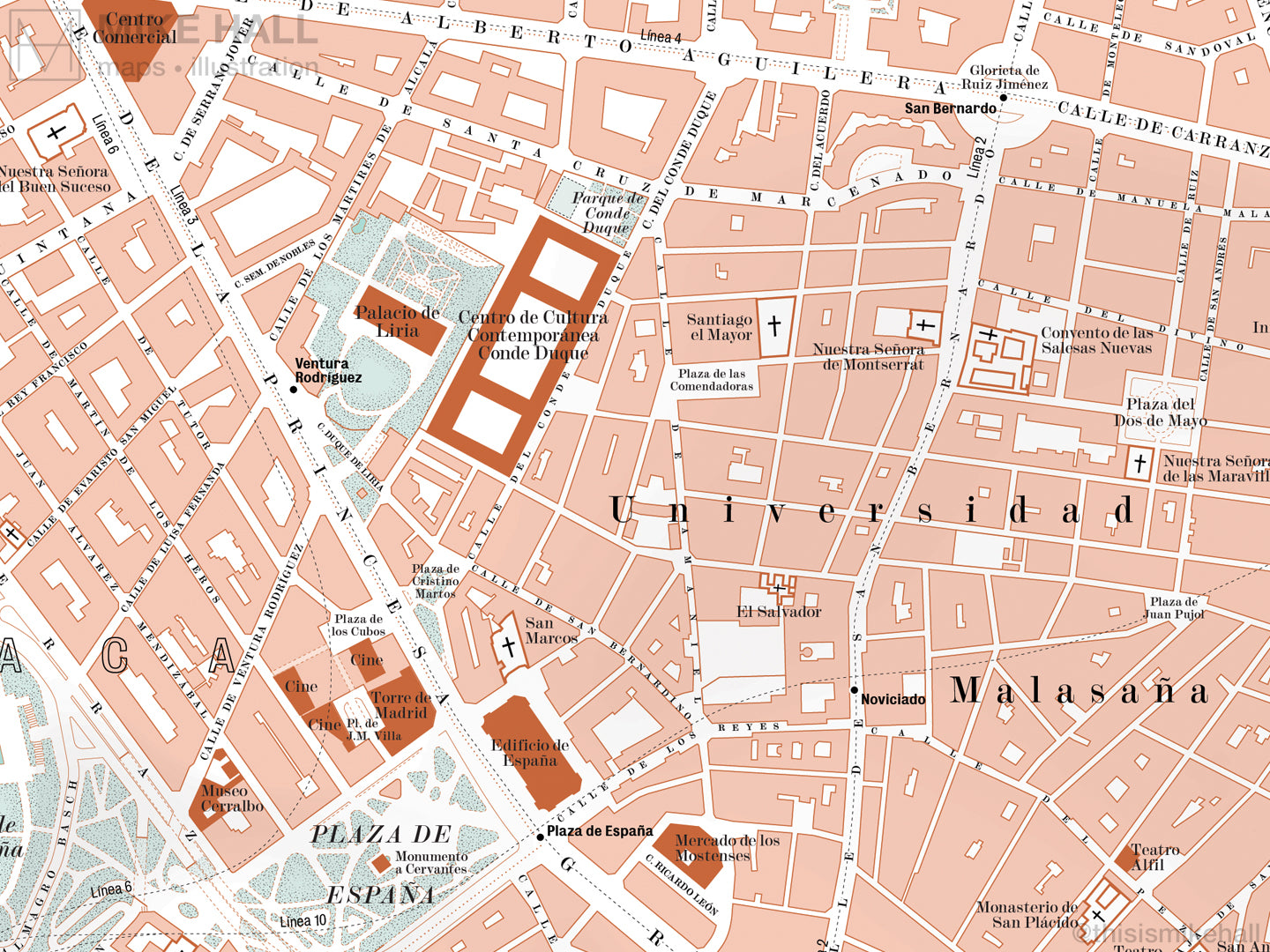
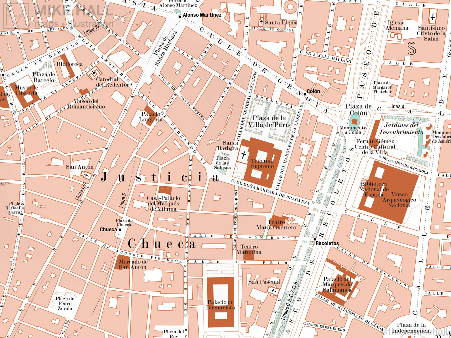
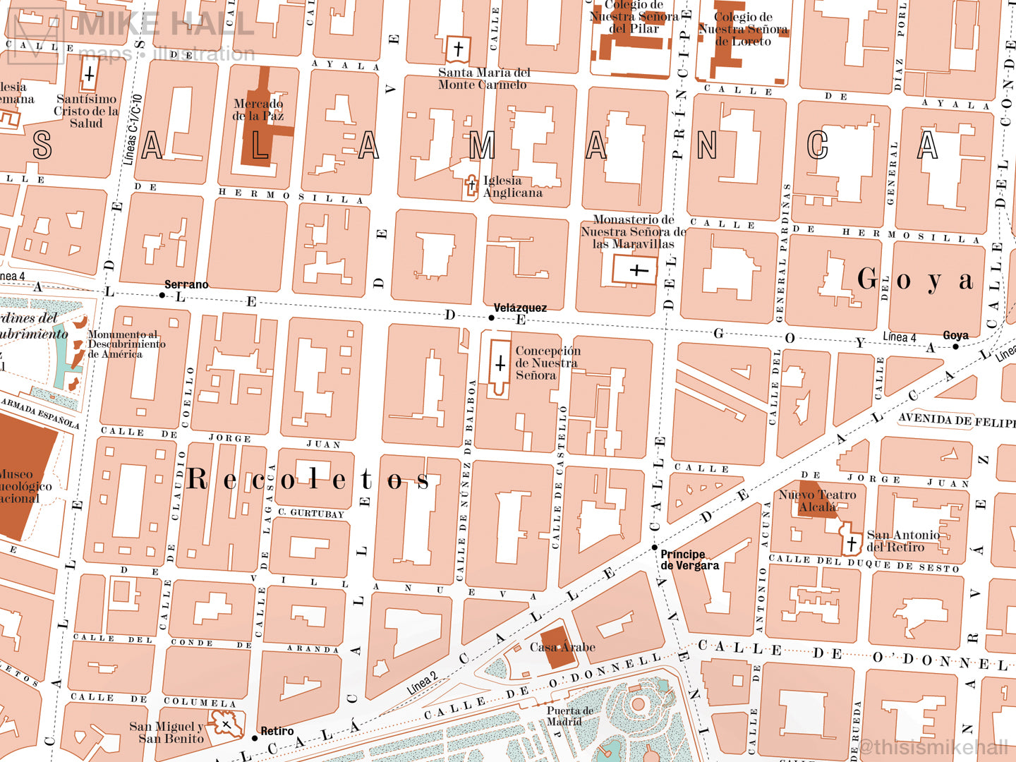
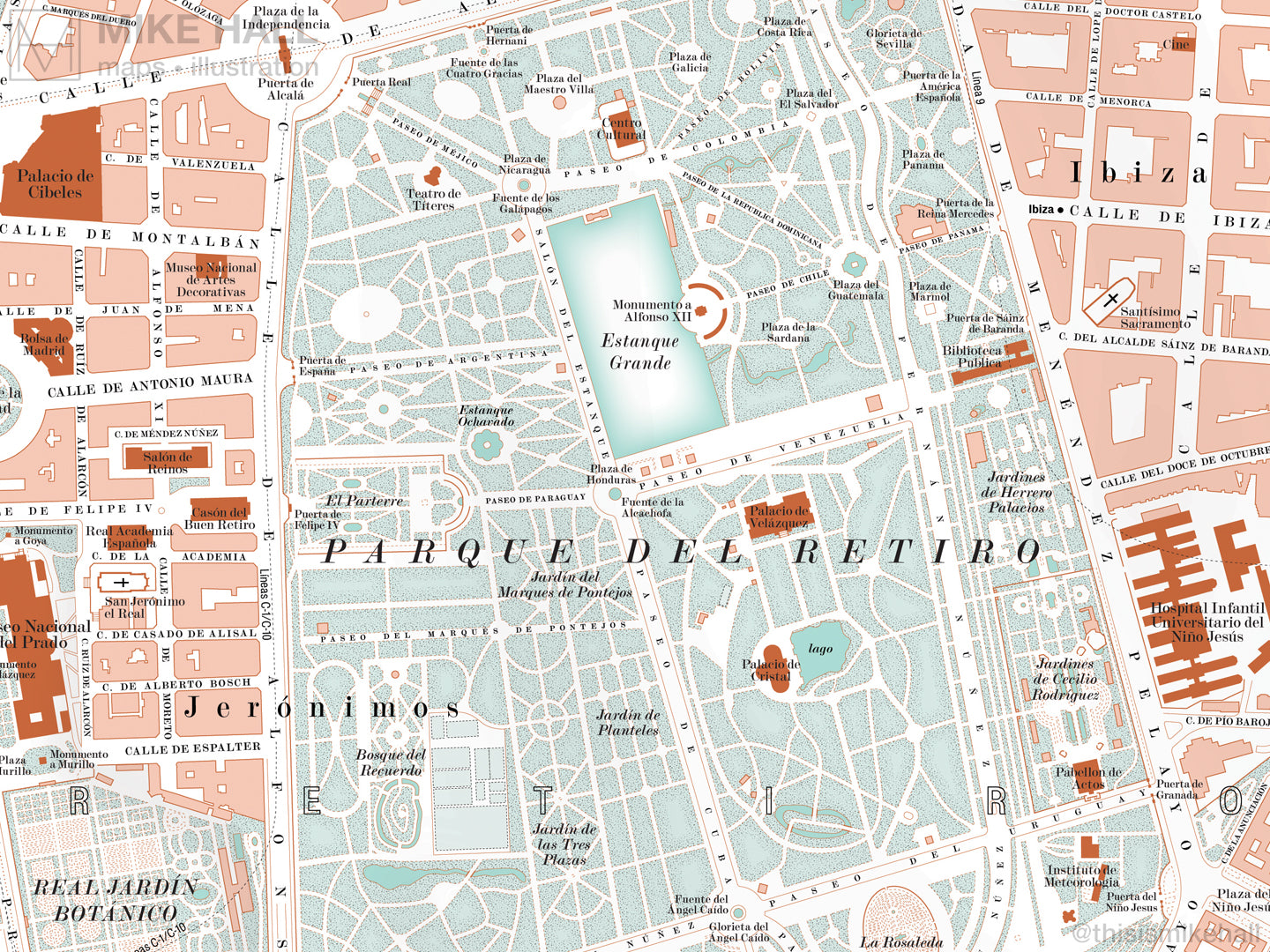
Free worldwide shipping on orders over £80, €100 or US$100

Madrid, Spain city map giclee print

Madrid, Spain city map giclee print


Regular price €50,00

Price excludes VAT Sale

This unique map of present-day Madrid, the capital city of Spain, is an original digitally rendered design inspired by the elegant visual style, coloration and typography of early twentieth-century guidebook maps.

Major streets and thoroughfares, railway termini, metro stations, landmarks, parks, gardens, lakes and bridges are all carefully delineated and labelled. The courses of the underground railways and metro lines are depicted by dashed black lines.

The map covers the entire central area of the city and includes the districts of Acacias, Almagro, Argüelles, Castellana, Chueca, Gran Vía, Huertas, Imperial, Jerónimos, La Latina, Lavapiés, Los Austrias, Malasaña, Pacífico, Palos de la Frontera, Puerta del Ángel, Recoletos, Salamanca and Sol. Featured landmarks include the Atocha railway station, Catedral de la Almudena, Museo del Prado, Palacio de Cibeles, Palacio Real, Plaza Mayor and the Plaza del Puerta del Sol.

The design is finished with a simple, elegant border and title, with a symbol key and scale bar along the bottom edge.

All names on the map are written in Spanish.

  • High quality digital giclee print on archival 230gsm paper
  • Available in two sizes: choose from the menu above
  • Signed in pencil by the artist, with a stamp of authenticity on the rear
  • Open edition - printed to order
  • Frame NOT included

Carefully packaged and delivered in a firm cardboard tube.

Take a closer look at the design in full here: